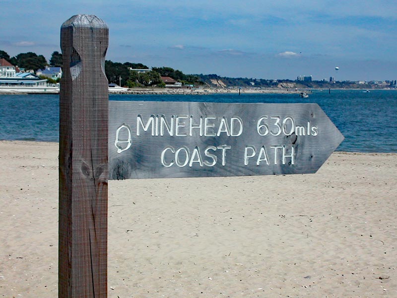
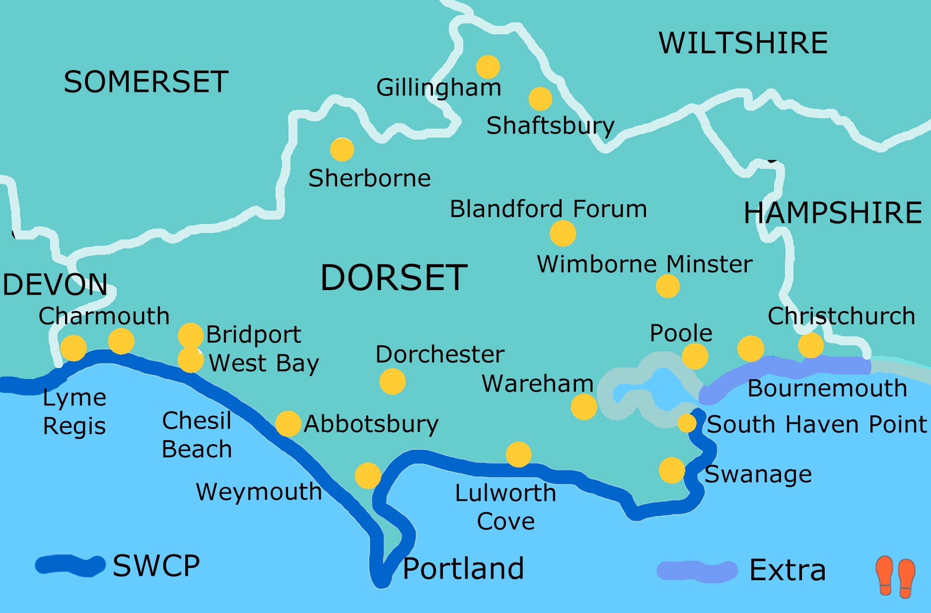
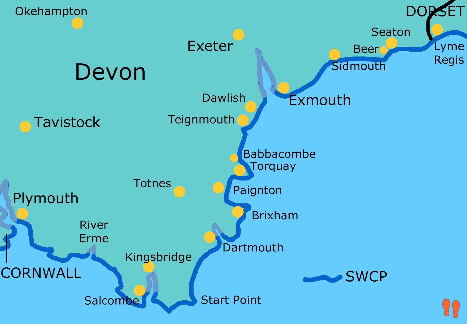
SWCP = South West Coast Path
ECP = England Coast Path
1999:
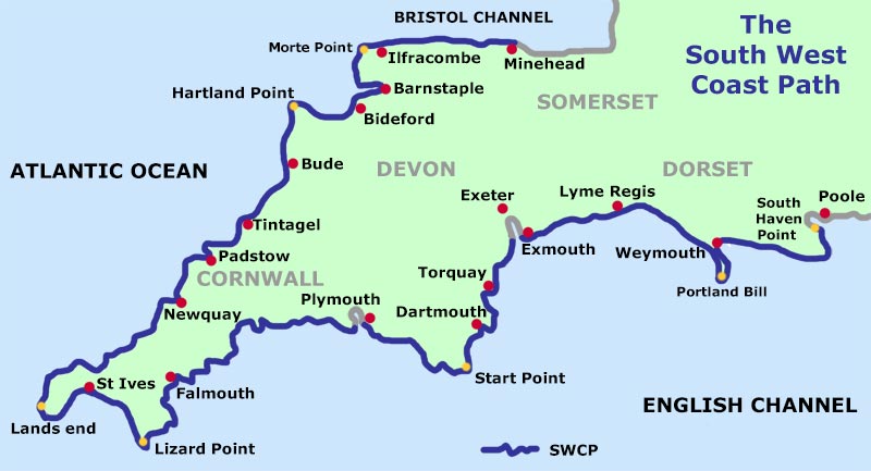
SWCP Minehead to Barnstaple
2000:
SWCP Barnstaple to Newquay
2002:
SWCP Falmouth to Plymouth
2003:
SWCP Plymouth to Lyme Regis
2004:
SWCP Lyme Regis to South Haven Point
2022:
SWCP in reverse South Haven Point to Lyme Regis
2023:
SWCP in reverse Lyme Regis to Plymouth
2024:
ECP Hampshire to South Haven Point
2025:
ECP Weston-Super-Mare to Minehead
This page is a mixture of styles and photograph formats as they were first produced at the time of the walks.
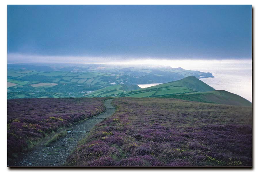
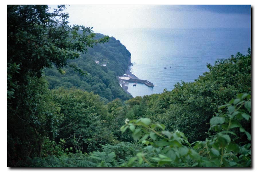
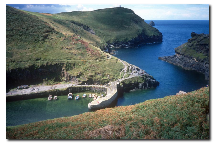
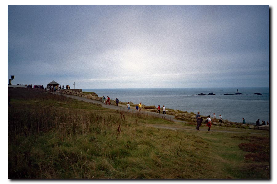
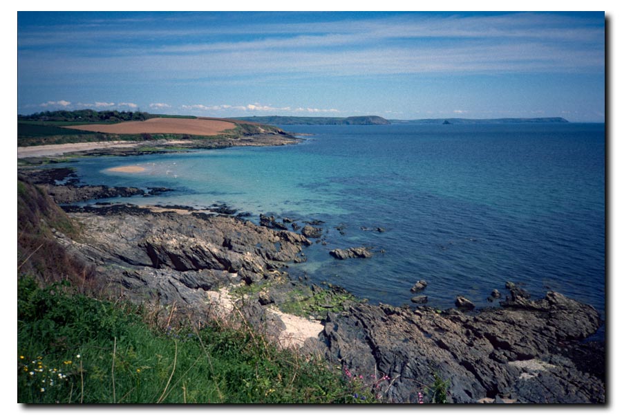
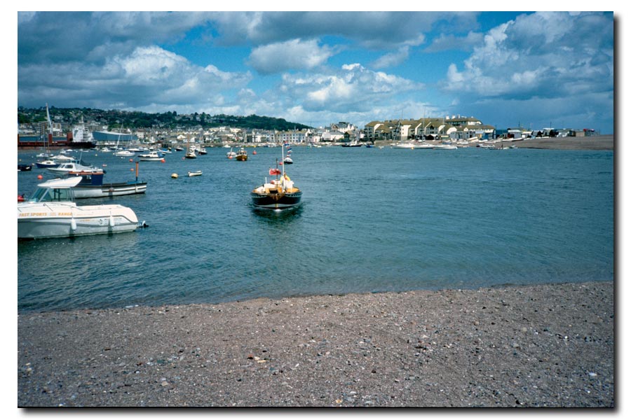
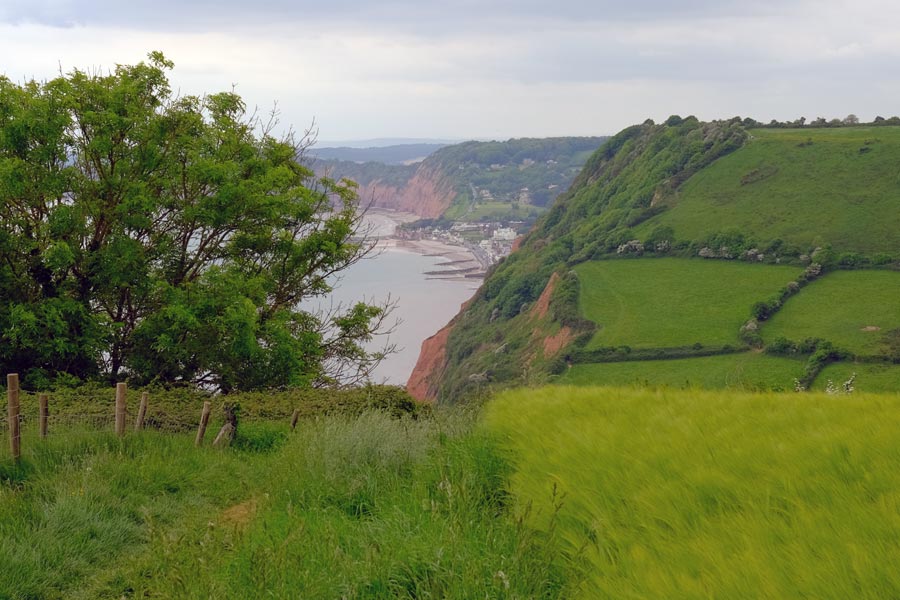
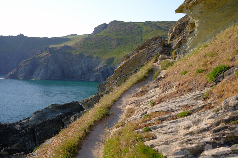
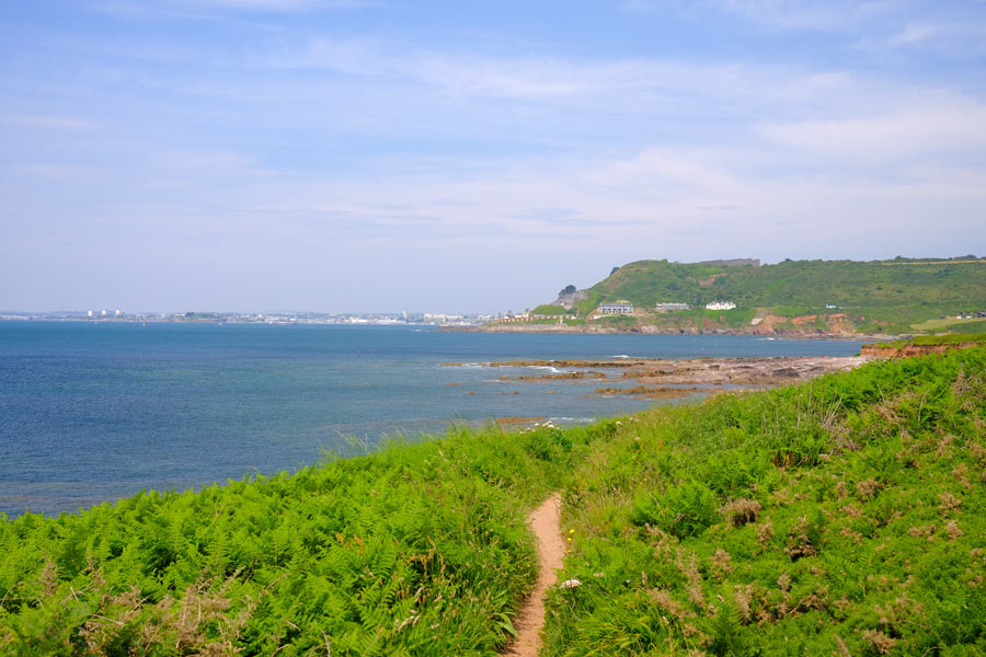
SWCP Minehead to Barnstaple 1999
Passing through: Porlock, Lynton, Lynmouth, Combe Martin, Ilfracombe, Morteho, Woolacombe, Croyde, Saunton, and Braunton.


I took a tent, a sleeping bag and an inflatable sleeping mat to give me more flexibility over where to stop if I could not find or chose not to stay in accommodation overnight.
I made notes of mileages, weather, accommodation and anything else of interest in the margins of the SWCP guide books that I took.
The photos for this section were taken with an Olympus XA film camera using Agfachrome 200 slide film and scanned for this website on a Nikon LS-50 ED negative and slide film scanner.
 |
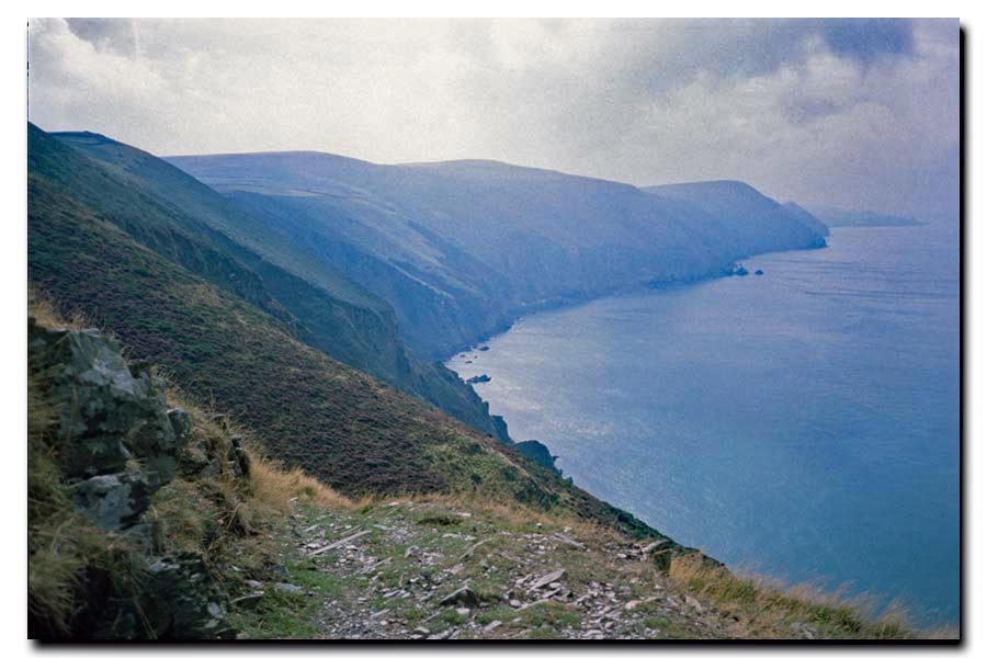 |
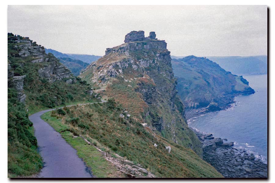
| Castle Rock just beyond Lynmouth. | View from East Cleeve. |
 |
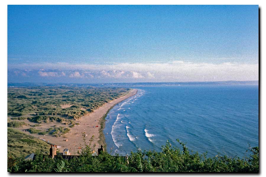 |
| On the Great Hangman above Combe Martin. | Saunton Sands with Braunton Burrows. |
At Barnstaple I had a wander around the town, as I had lived there for a time when I was a teenager. I had a pint in the Three Tuns for old times sake then caught a train home. I was working then and had to be back at work on Monday.
Minehead to Barnstaple: About 68 miles walked. 5 days.
Best:
Arriving at Ilfracombe at 1pm on Carnival day and deciding to stop, get a room, dry out, chill out, and later have a few beers and watch the fun.
Worst:
Miles of damp woods with no views, Porlock to Foreland Point. Nice if you love woodlands though.
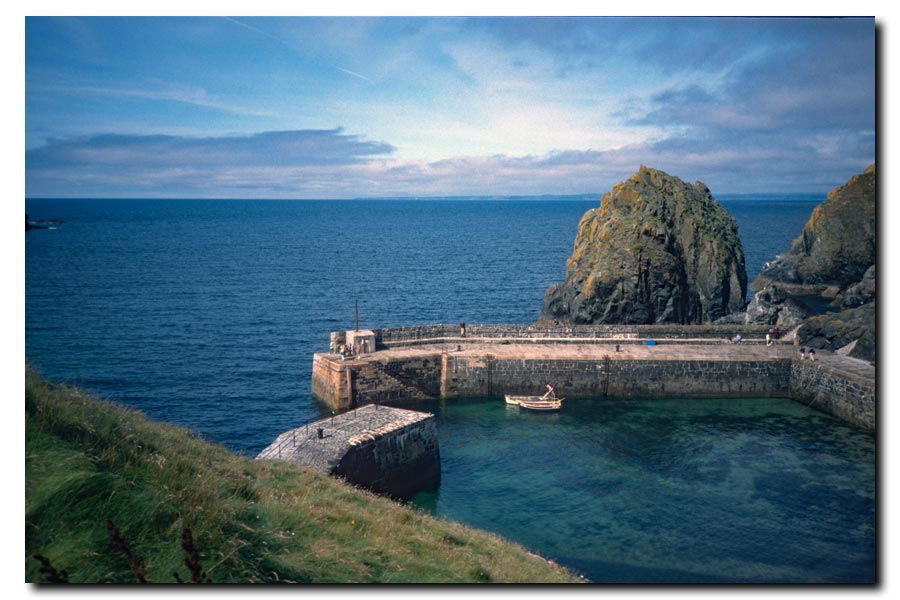
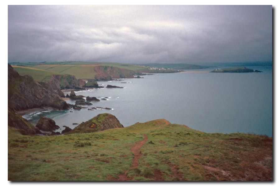
SWCP Barnstaple to Newquay 2000
Passing through: Instow, Bideford, Apledore, Westward Ho!, Clovelly, Hartland Quay, Bude, Widemouth Bay, Cracklinton Haven, Boscastle, Tintagel, Port Gaverne, Port Isaac, Port Quin, Polzealth, Trebetherick, Rock, (ferry).
When walking from Minehead to Barnstable last year I overloaded myself with camping gear, so for this year I pre-booked my accommodation in advance. My rucksack was much lighter and had nothing strapped to it.
I was still using the same Olympus mju II film camera.
 |
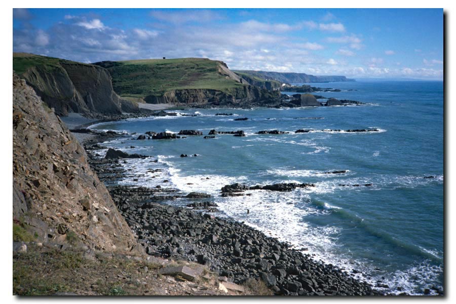 |
| Clovelly harbour through the trees. | Cliffs near Hartland. |
 |
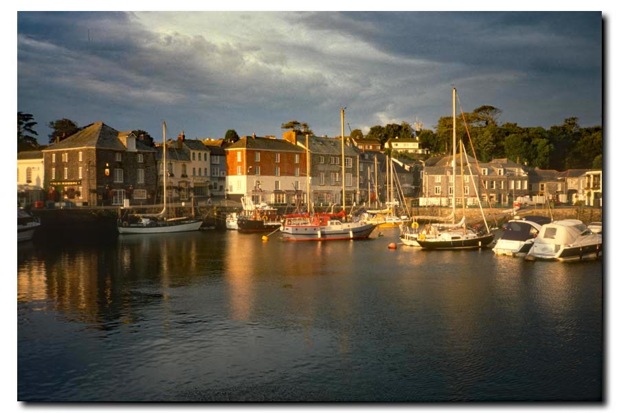 |
| Boscastle Harbour. | Padstow Harbour. |
Barnstaple to Newquay. About 125 miles walked. 7 days.
Total so far 192 miles. 12 days.
I ended this section at Newquay because it had a railway station. Back to work on Monday.
Notable: Mrs Dann's B&B.
After a hard 20 mile walk from Tintagel, my B&B in Padstow town centre took some time to find. There was a notice on the door: "Ring the bell and wait at least two minutes. Don't ring again. My feet won't get there any quicker". Another notice said: "No en-suite rooms. No TV in the rooms. No single rooms - you will have to pay extra".
When I told Mrs Dann that I wanted to leave at 7 am the next morning, she told me that I was "leaving too early for breakfast" and that I "still had to pay full price". I asked about a packed lunch instead but she "didn't do packed lunches". I was worn out and needed to rest, so I paid up.
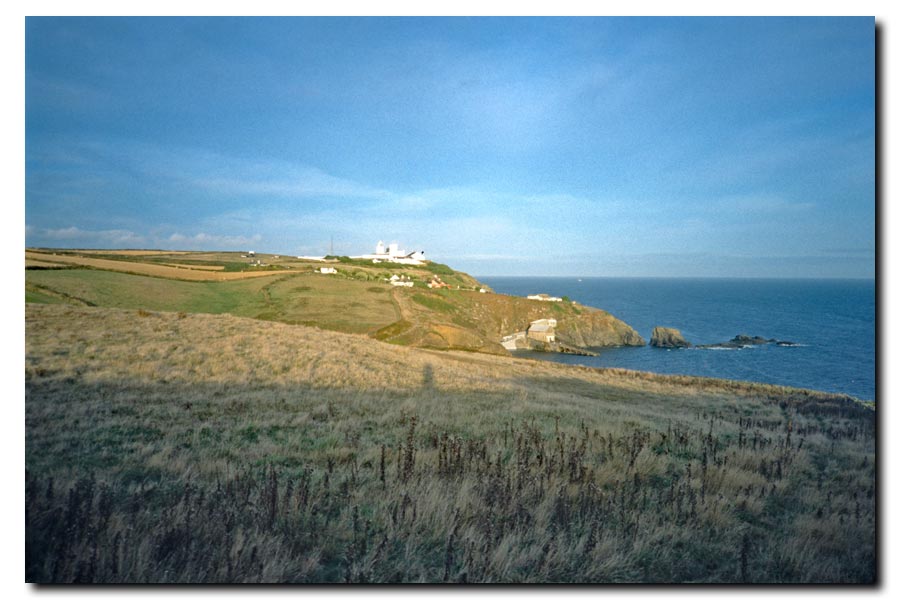
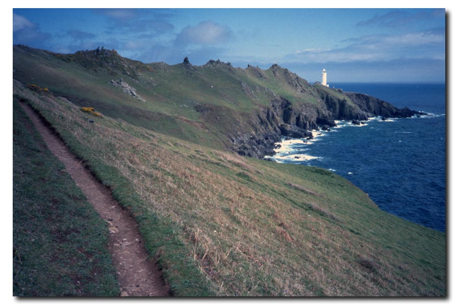
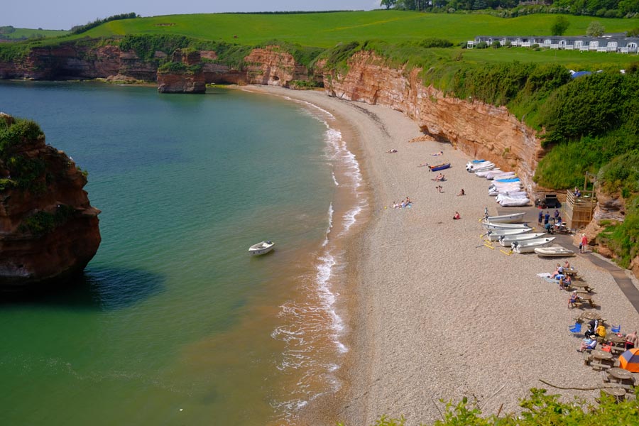
SWCP Newquay to Falmouth 2001
Passing through: Perranporth, St Agnes, Porthtowan, Portreath, Hayle, Carbis Bay, St Ives, Sennen Cove, Porthcurno, Mousehole, Newlyn, Penzance, Marazion, Porthleven, Mullion Cove, Lizard Point, Cadgwith, Coverack, Helford, (ferry).

I pre-booked my accommodation for this section.
The photos for this section were taken with an Olympus mju II camera using Agfachrome 200 slide film and scanned for this website on a Nikon LS-50 ED.
 |
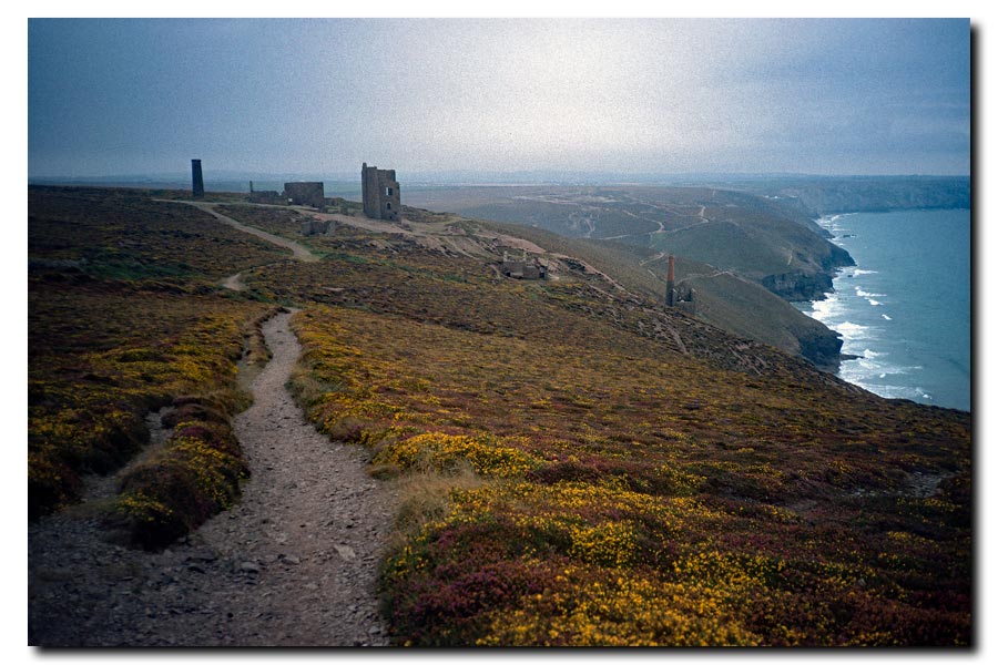 |
| Perran Beach, Perranporth. | Ruins of tin mines. |
 |
 |
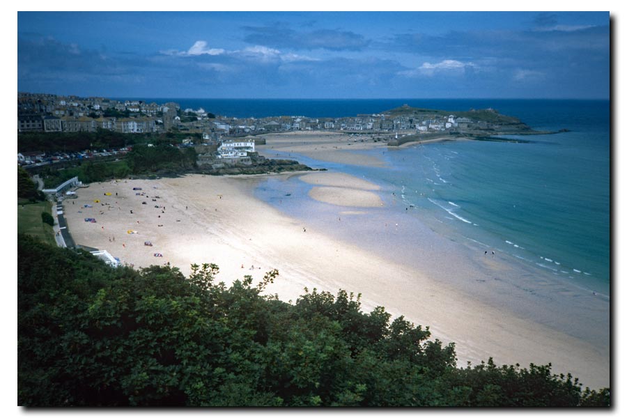
| Approaching St Ives. | Lands End. |
 |
 |
| Leaving Mullion Harbour. | Approaching Lizard Point. |
Newquay to Falmouth: About 150 miles walked. 10 days.
Total so far: 341 miles. 22 days.
Best: My cosy accommodation in a little cabin next to a stream at Lamorna Cove.
Worst: I stopped for the night at Coverack and went into the bar of the Paris Hotel where I saw the pictures of the destruction of the Twin Towers on the television. It was September 11th.
Next day, shortly after I had set out, I decided to abandon my walk. I couldn't get those pictures out of my head. I had intended to reach Plymouth but I knew that I wouldn't enjoy the walk now. I walked to Falmouth and took the next train home.
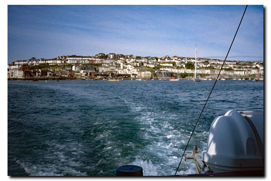
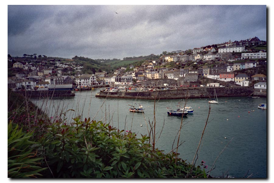
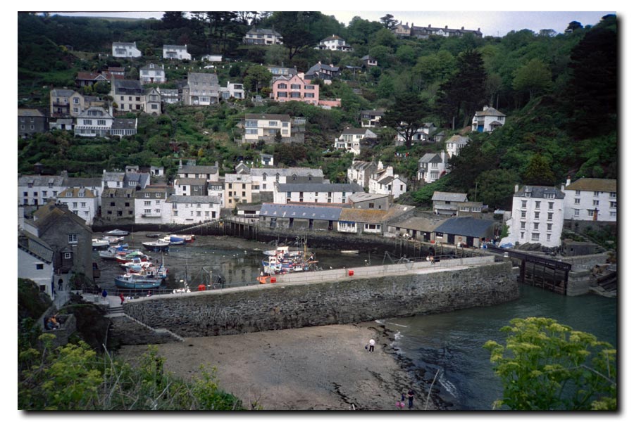
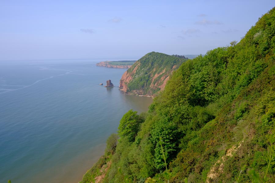
SWCP Falmouth to Plymouth 2002
Passing through: (ferry), St Mawes, (ferry), Mevagissey, St Austel, Par, Fowey, (ferry), Polperro, Looe, Portwrinkle, Cremyll, (ferry).
I pre-booked my accommodation again for this section.
I was still using the same Olympus mju II film camera.
 |
 |
| Falmouth to St Mawes ferry. | Porthcurnick Beach from Pednaven. |
 |
 |
| Mevagissey. | Lantic Bay. |
 |
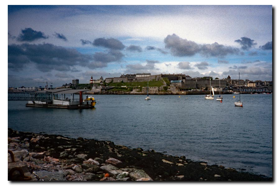 |
| Polperro. | Cremyll ferry to Plymouth. |
Falmouth to Plymouth: About 74 miles walked. 5 days.
Total so far: 415 miles. 27 days.
Best: Meeting up with Bob Williams, a fellow lone walker, and chatting in the pub several evenings at stops along the way.
Worst: Walking the dusty paths with high rusty fences weaving between abandoned buildings at Par.
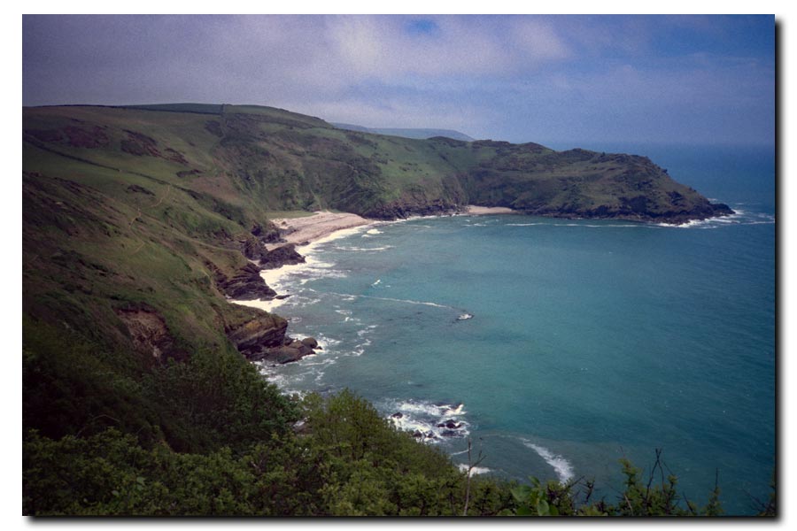
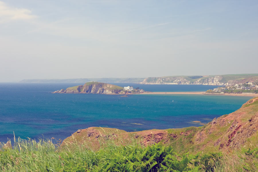
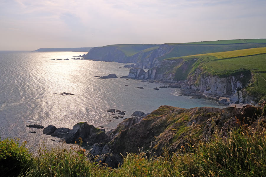
SWCP Plymouth to Lyme Regis 2003
Passing through: (ferry), Mountbatten, Wembury, (ferry), (wading*), Bigbury on Sea, Salcombe, Torcross, Stoke Fleming, Dartmouth, (ferry), Kingswear, Brixham, Goorington, Paignton, Torquay, Teignmouth, Dawlish, Starcross, (ferry), Exmouth, Budleigh Salterton, Sidmouth, Beer and Seaton.
* Wading the River Erme at low tide only.
I decided not to pre-book any accommodation for this section. During the last few sections there were several times when I had to keep going to get to my accommodation and other times when I wanted to keep going but had to stop because I had got there. This time I took a light sleeping bag and a bivvy bag in case I could not find anywhere to stay, or did not want to sleep indoors.
I was still using the same film camera.
 |
 |
| Aproaching Bigbury-on-Sea. | Aproaching Start Point. |
 |
 |
| Torcross. | Teignmouth Ferry. |
 |
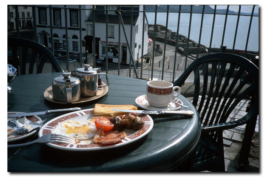 |
| The Jurassic Coast. | Breakfast in Lyme Regis. |
Plymouth to Lyme Regis: About 122 miles walked. 10 days.
Total so far: 537 miles. 37 days.
Bests: Sleeping out under the stars and having breakfast next day in Lyme Regis.
Worst: Having to wade thigh deep across the Erme Estuary in the dark at low tide, not reaching the opposite bank in the right place and climbing a steep muddy stinging nettled bank with no boots or socks on.
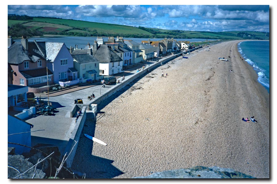
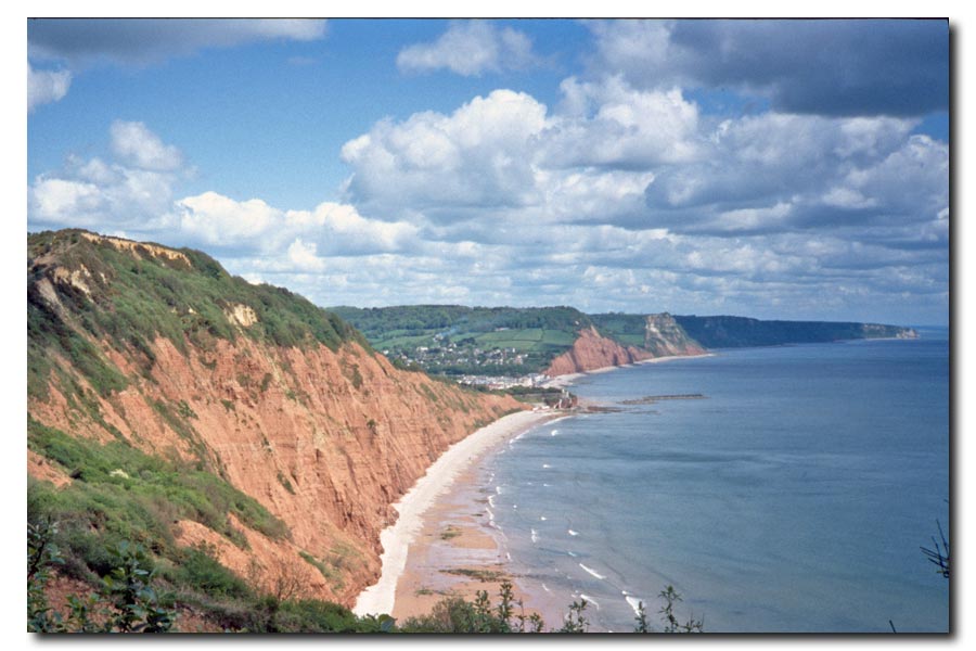
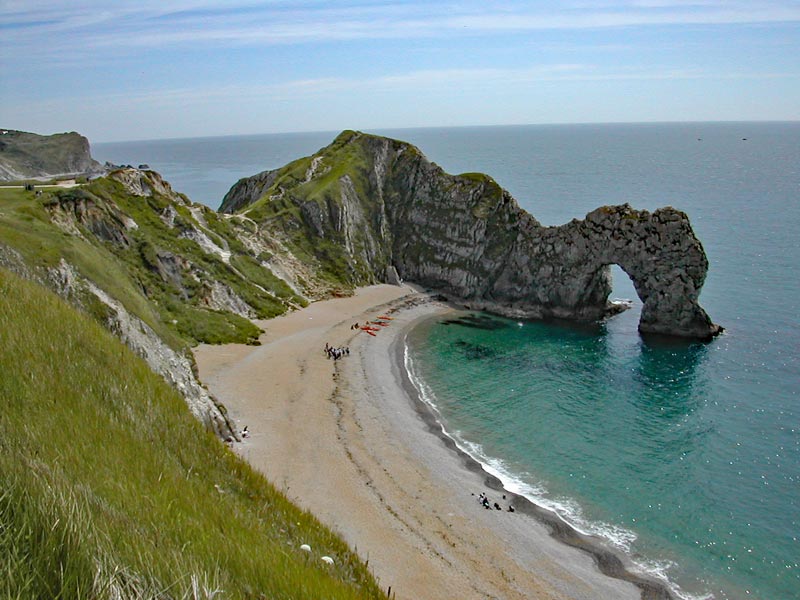
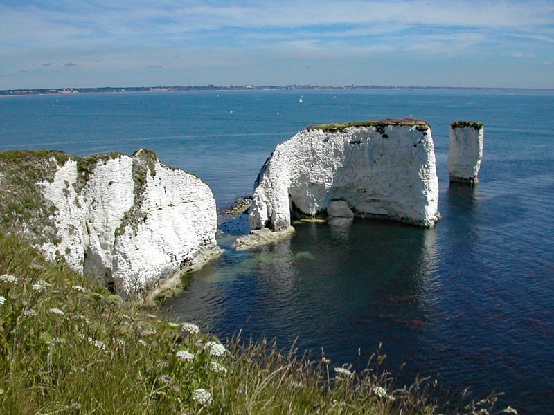
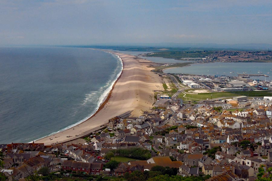
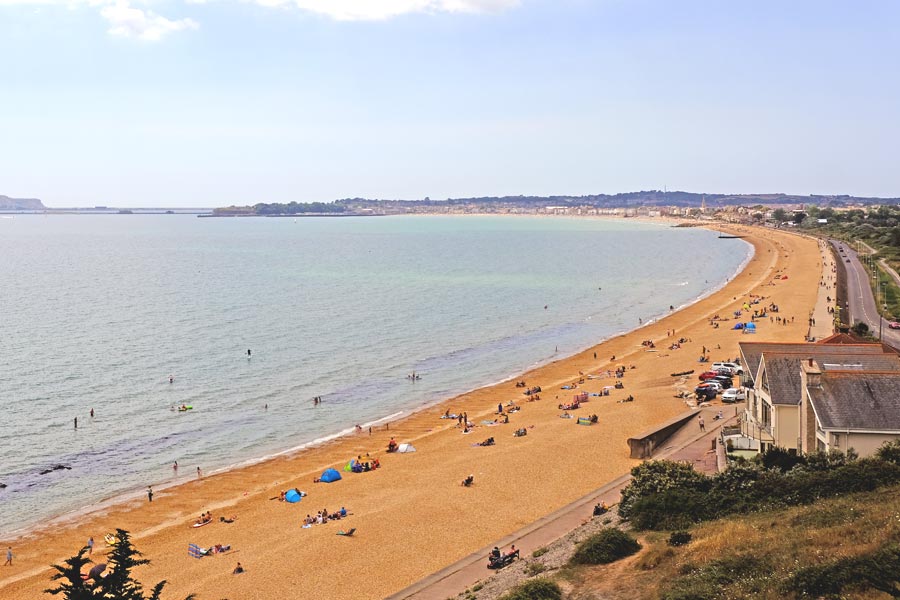
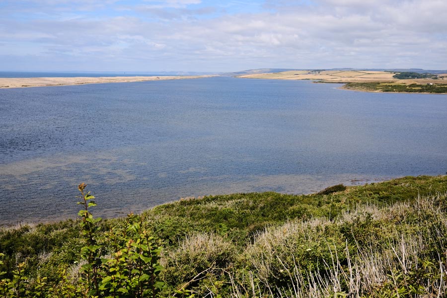
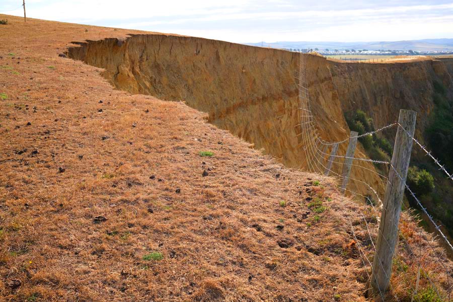
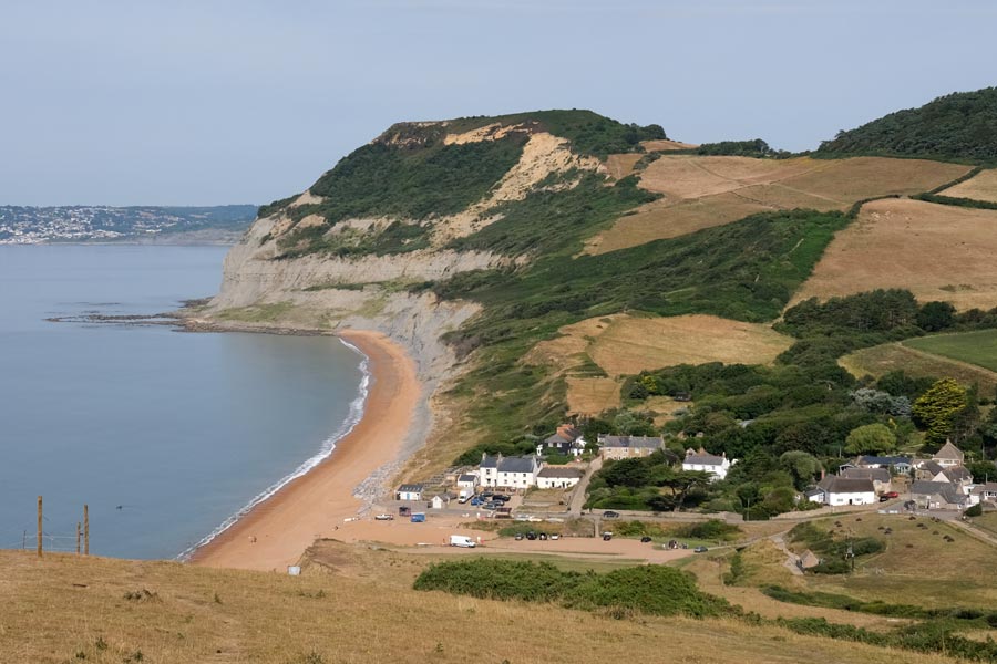
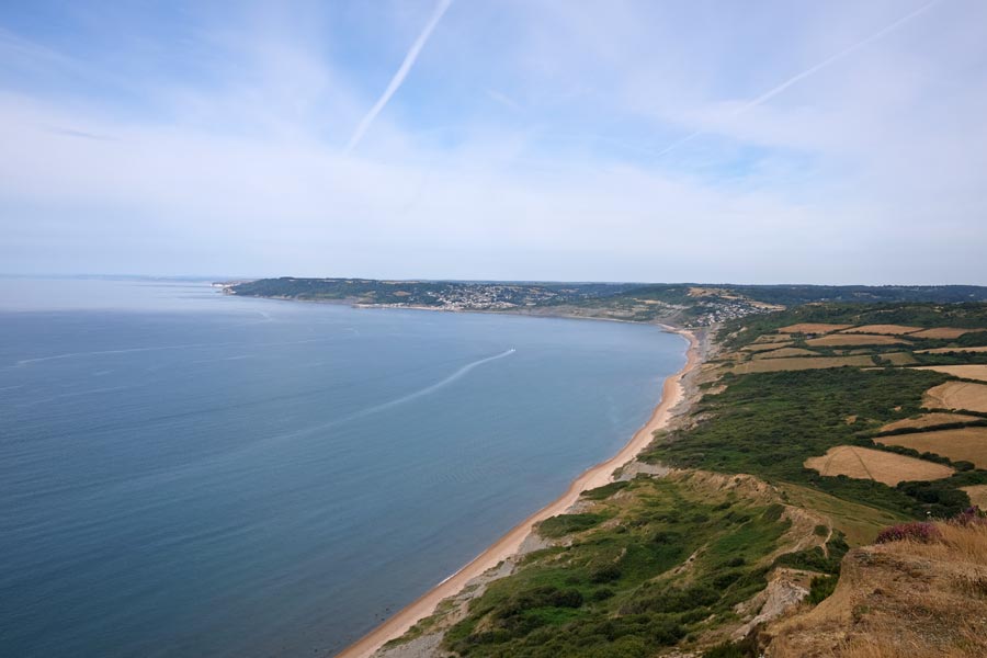
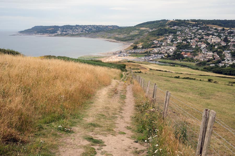
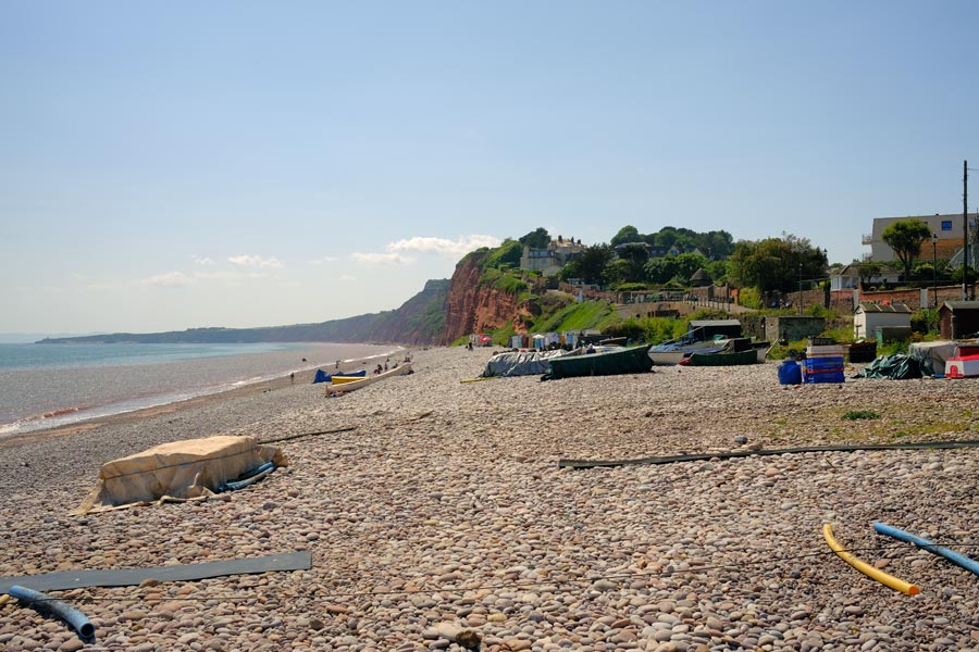
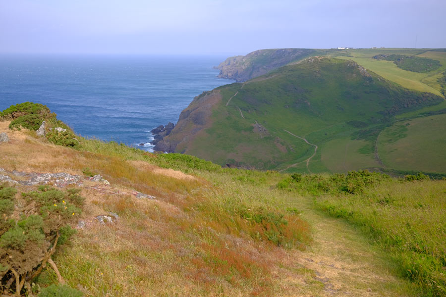
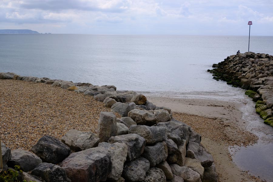
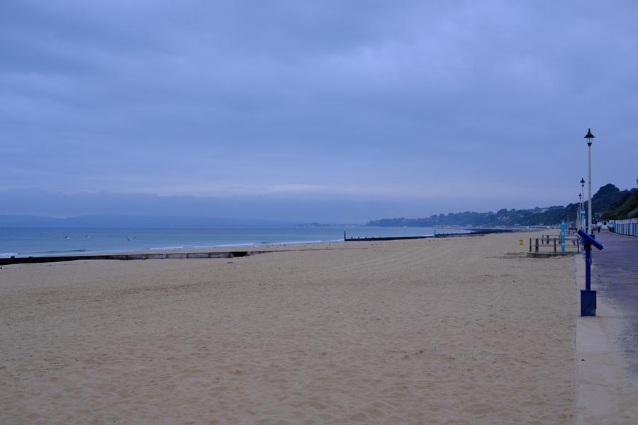
SWCP Lyme Regis to South Haven Point 2004
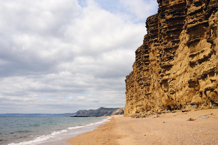
Passing through: Charmouth, Seatown, West Bay, Abbotsbury, Weymouth, Osmington Mills, Durdle Dor, Swanage and Studland.

I didn't need accommodation for this section because I had retired and moved to West Dorset at the end of 2003. So I was able to take buses to and from the start and finish points.
The photographs for this section were taken on a Nikon Coolpix 775 digital camera.
 |
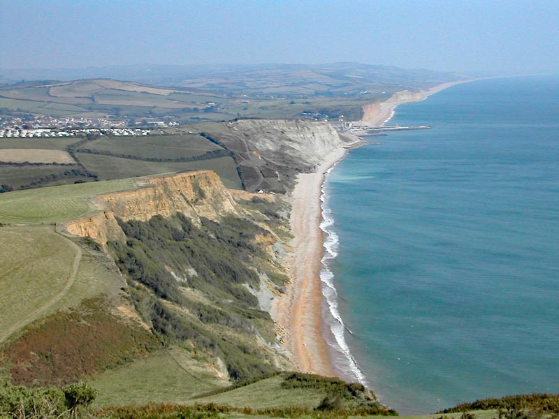 |
| Approaching Golden Cap. | West Bay. |
 |
 |
| Durdle Dor. | Swanage. |
 |
 |
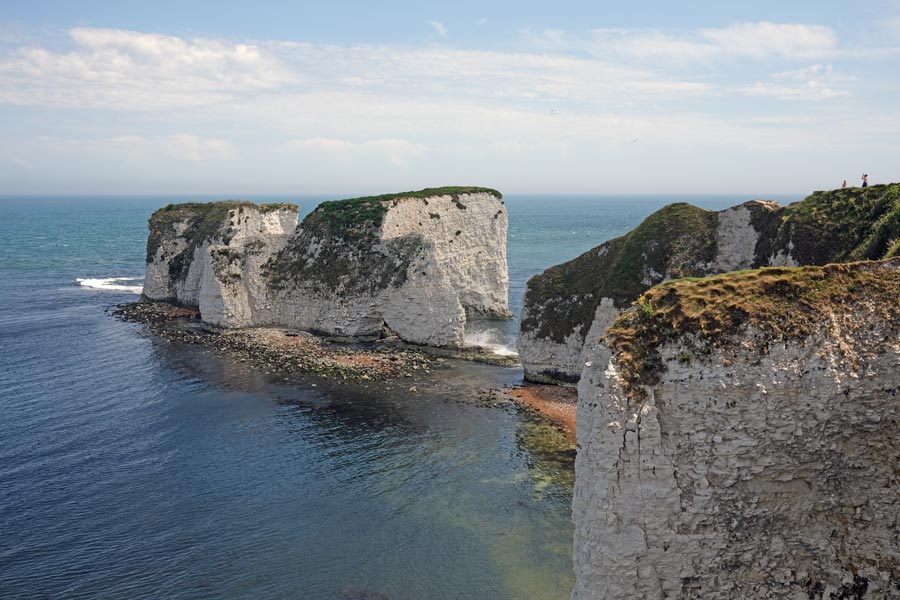
| Old Harry Rocks. | South Haven Point. |
Lyme Regis to South Haven Point: About 79 miles walked. 5 days.
Best: Everything.
Worst: Nothing.
Total: Minehead to South Haven Point: 613 miles. 42 days.
Only 613 miles? Yes. The Isle of Portland was not part of the SWCP when I started out, but it was by the time I reached the end, so I walked it later and added 17 miles and 1 day to my totals.
Final total: 630 miles. 43 days.
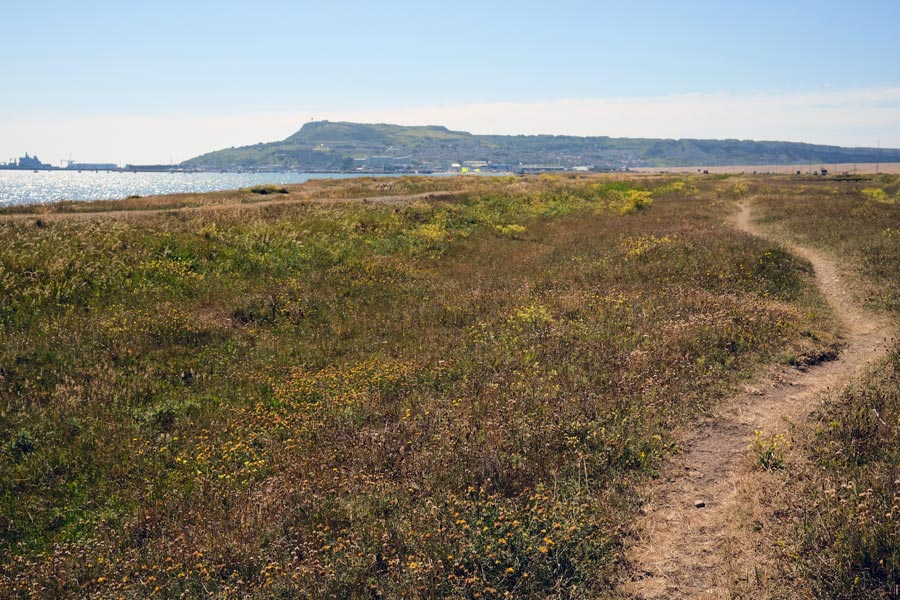
Portland
 |
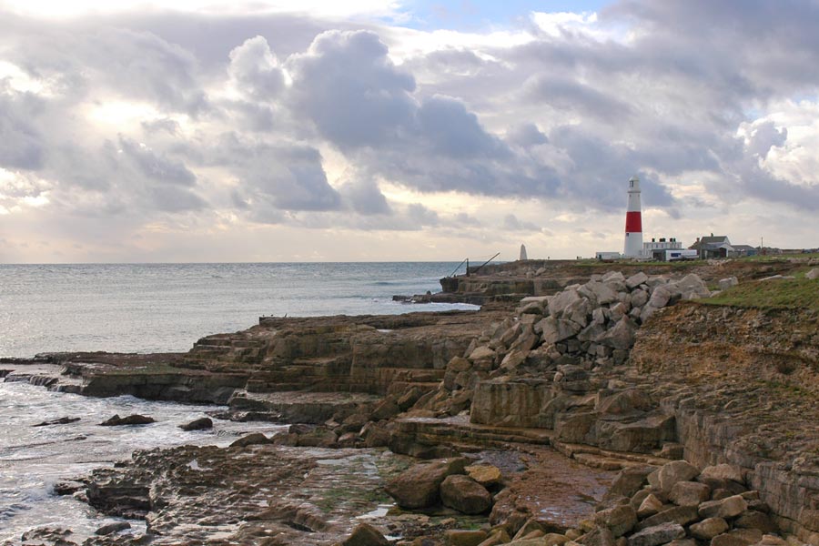 |
| Chesil Beach and causway. | Portland Bill. |
Day 1: South Haven Point to Langton Maltravers
Day 2: Langton Maltravers to Kimmeridge
Day 3: Kimmeridge to Lulworth
Day 4: Lulworth to Weymouth
Day 5: Round the Isle of Portland
Day 6: Weymouth to Abotsbury
Day 7: Abotsbury to West Bay
Day 8: West Bay to Lyme Regis

Walking in the opposite direction to my first walk in 1999 - 2004.
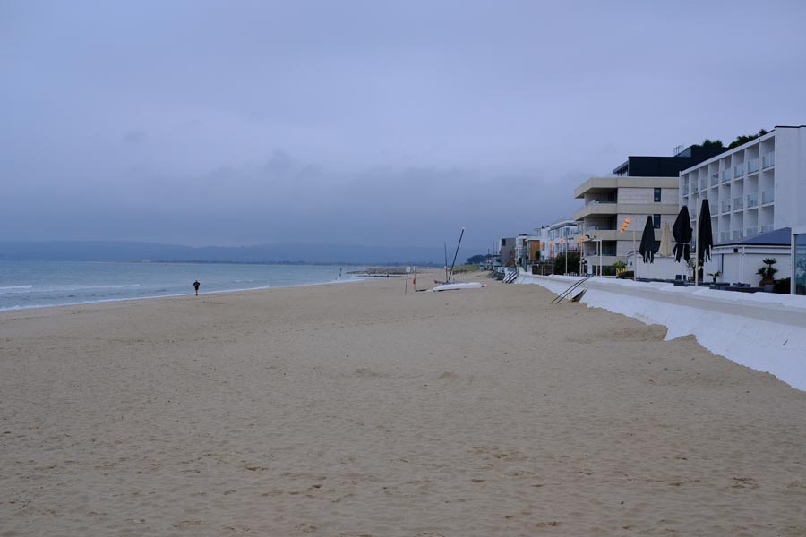
The photos for the following sections were taken on a Fujifilm X100V which has a fixed 23mm f2 medium wide-angle lens.
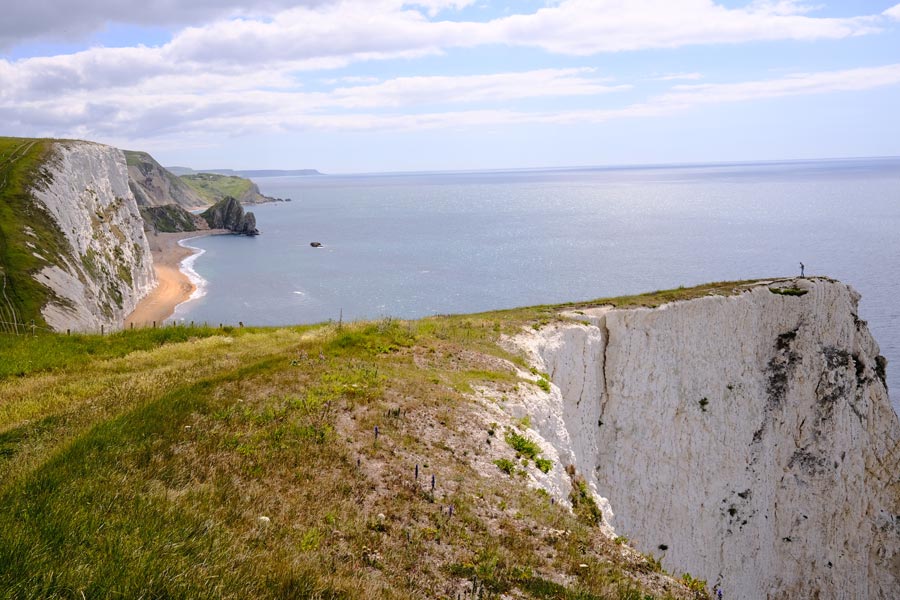
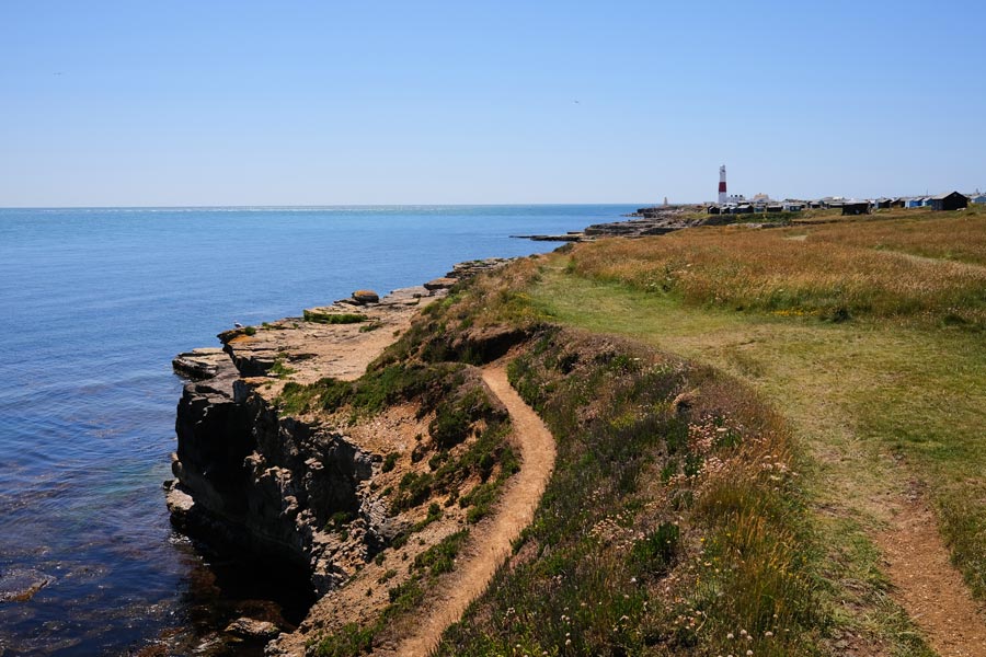
Day 1 - SWCP South Haven Point to Langton Maltravers
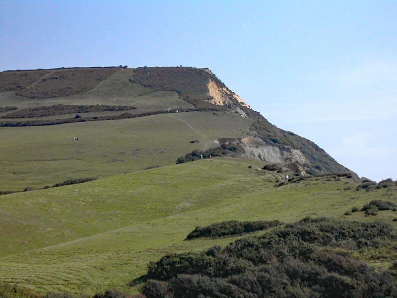
Old Harry Rocks
Swanage Bay
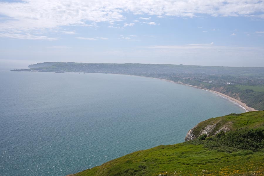
End of day 1. About 11 Miles walked today. It was hot day with a few clouds now and then, including a short downpour just as I headed inland for the bus stop at Langton Maltravers. This turned out to be the only time that I got wet on my walk along the Dorset coast.
back to start of Dorset in reverse
Day 2 - SWCP Langton Maltravers to Kimmeridge.
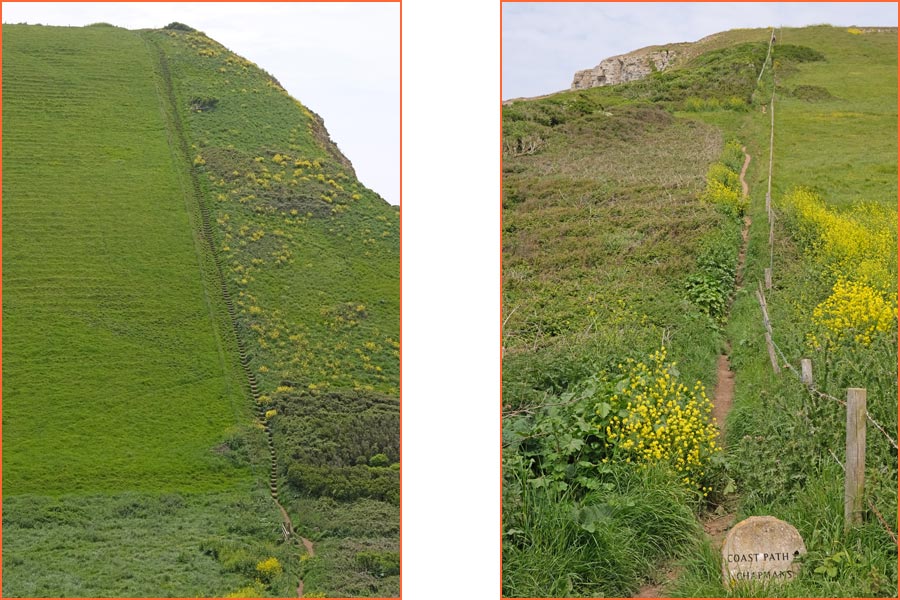
On the way to Chapman's Pool
Almost at Kimmeridge
End of day 2. About 10 miles walked today. Hot.
back to start of Dorset in reverse
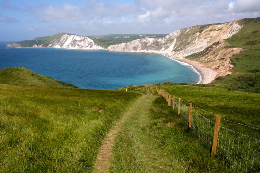
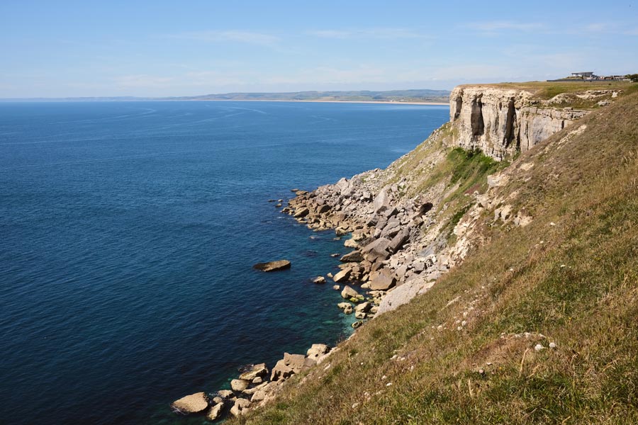
Day 3 - SWCP Kimmeridge to Lulworth
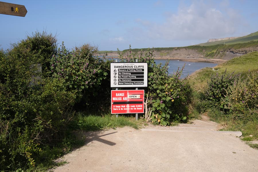
The Lulworth Range Warning Notice.
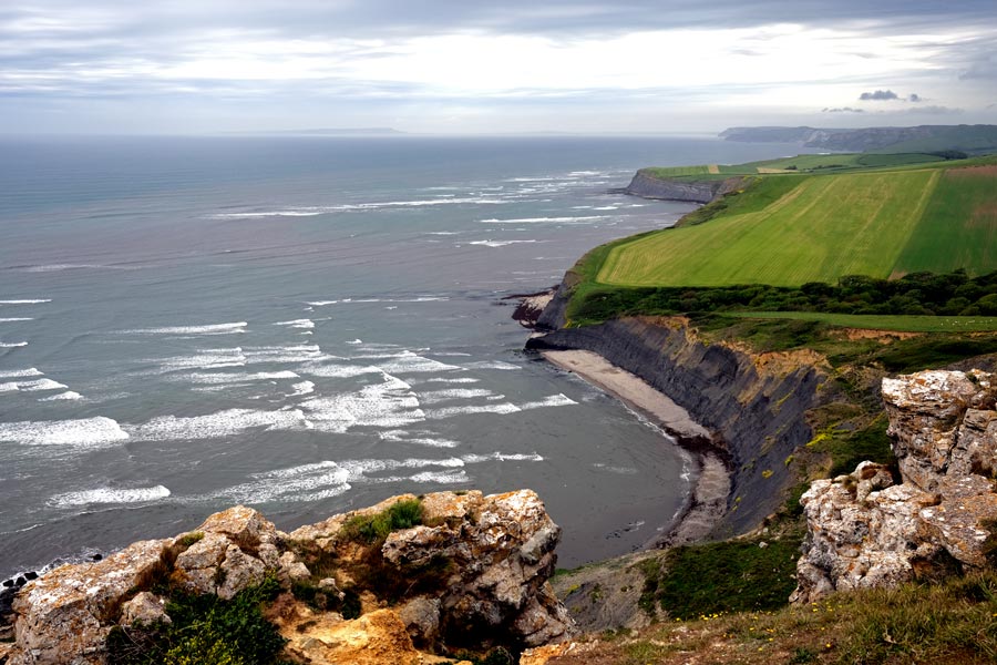
Brandy Bay
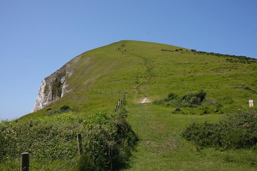
I'm not sure where this is. Possibly Rings Hill.
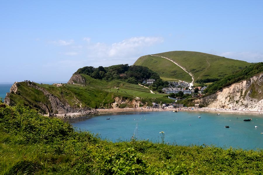
Lulworth Cove
End of day 3. Only 8 miles walked today, but it was a severe section, and it was very hot!
back to start of Dorset in reverse
Day 4 - SWCP Lulworth to Weymouth

Durdle Dor

Another hill.
Looking back
Ringstead Bay
Osmington Mills
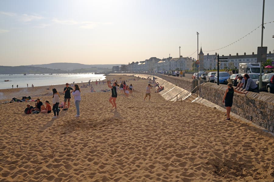
Weymouth Beach
End of day 4. About 13 miles walked today. It was a hot day with a few clouds now and then.
back to start of Dorset in reverse
Day 5 - SWCP From Weymouth round the Isle of Portland
Portland
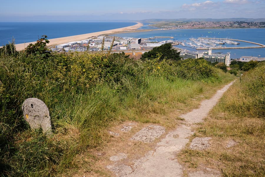
At the top of the Merchant's Incline
The under-cliff
Portland Bill
West Cliff
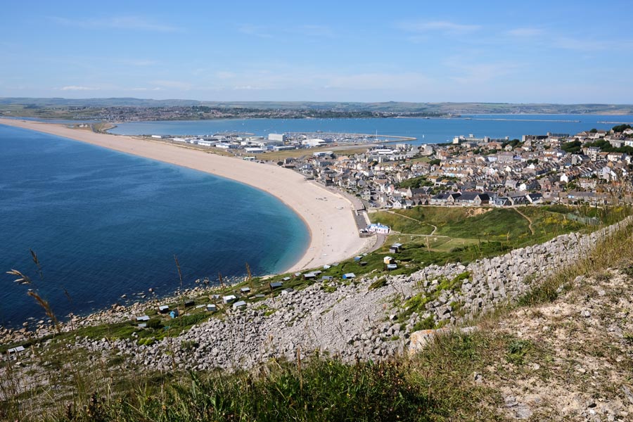
Chiswell
End of day 5. 16 miles walked today. A hot day but there was a cool breeze on the west facing cliffs and when walking back along the causeway.
back to start of Dorset in reverse
Day 6 - SWCP Weymouth to Abbotsbury
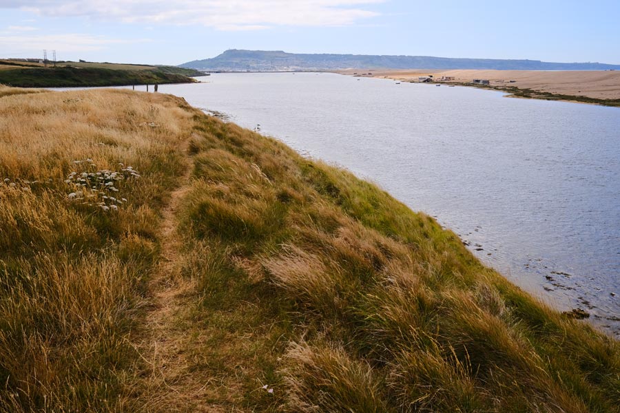
The Fleet
The Fleet
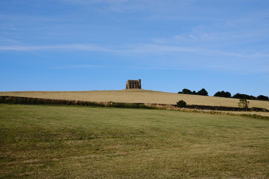
St Catherine's Chapel
End of day 6. Ending at Abbotsbury. About 12 miles walked today. A hot day with very little cloud.
back to start of Dorset in reverse
Day 7 - SWCP Abbotsbury to West Bay
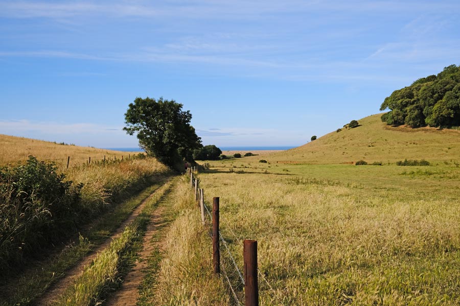
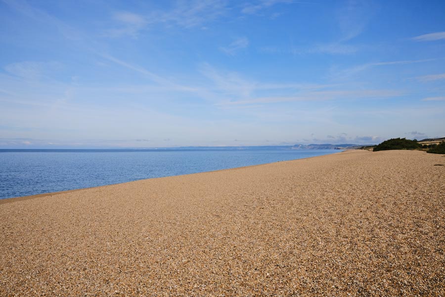
Chesil Beach
Burton Bradstock
Burton Freshwater
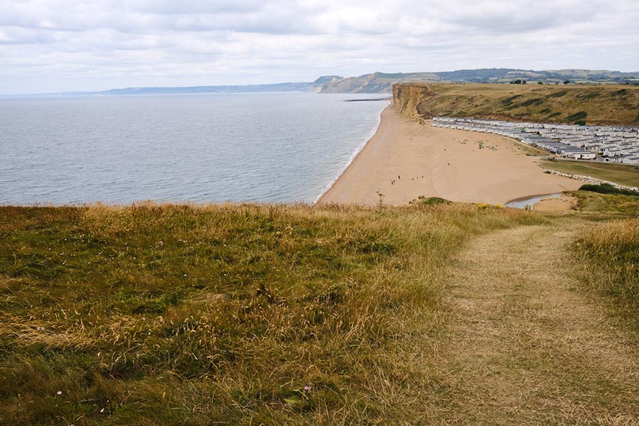
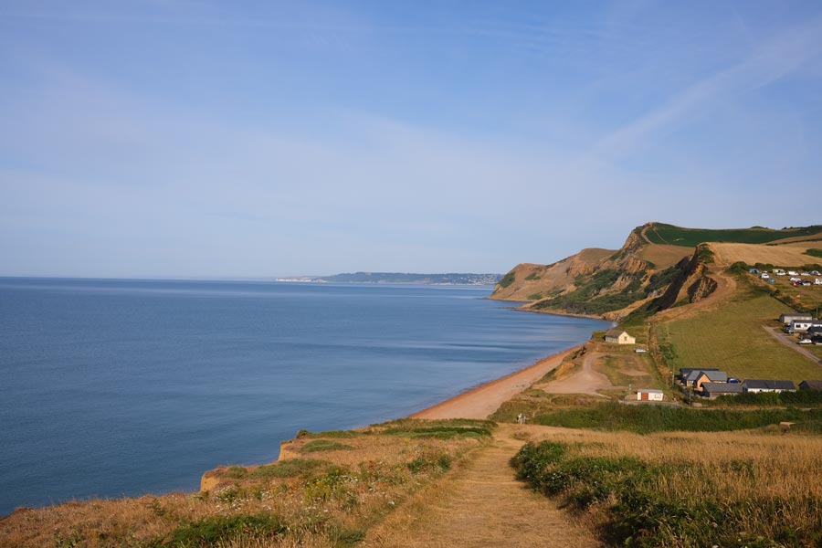
East Cliffs West Bay
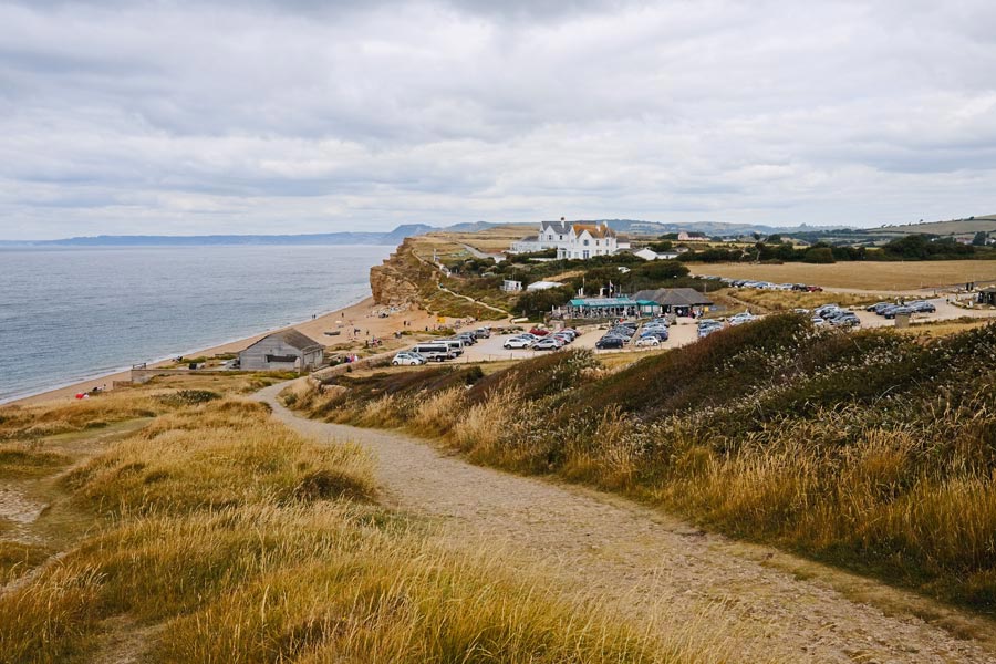
West Bay, also known as Bridport Harbour, is a small coastal community with a large static-caravan park. It also has harbour-side kiosks selling food, including fish & chips and ice-cream. I followed the footpath through the caravan park to Bridport which is almost 2 miles inland, where I had a pint in the The Pursuit of Hoppiness before catching a bus home.
End of day 7. About 9 miles walked today. A hot day to start with but later the clouds helped to cool it a little.
back to start of Dorset in reverse
Day 8 - SWCP West Bay to Lyme Regis
Eype Mouth
Thorncombe Beacon.
Seatown
View from Golden Cap
Charmouth
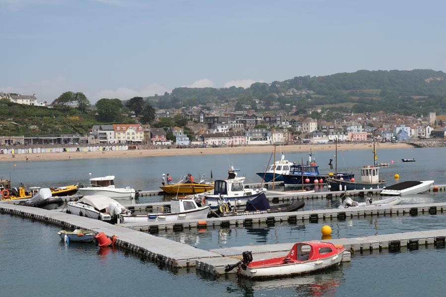
Lyme Regis. Photo taken from The Cobb.
End of day 8. About 10 miles walked today.
That's a total of 89 miles on the Dorset SWCP.
back to start of Dorset in reverse
Day 1: Lyme Regis to Beer
Day 2: Beer to Sidmouth
Day 3: Sidmouth to Exmouth
Day 4: Exmouth to Teignmouth
Day 5: Teignmouth to Babbacombe
Day 6: Babbacombe to Brixham
Day 7: Brixham to Dartmouth
Day 8: Dartmouth to Salcombe
Day 9: Salcombe to River Erme
Day 10: River Erme to Plymouth
The photos for these sections were taken on a Fujifilm X100V which has a fixed 23mm f2 medium wide-angle lens.
Day 1 - SWCP in reverse Lyme Regis to Beer
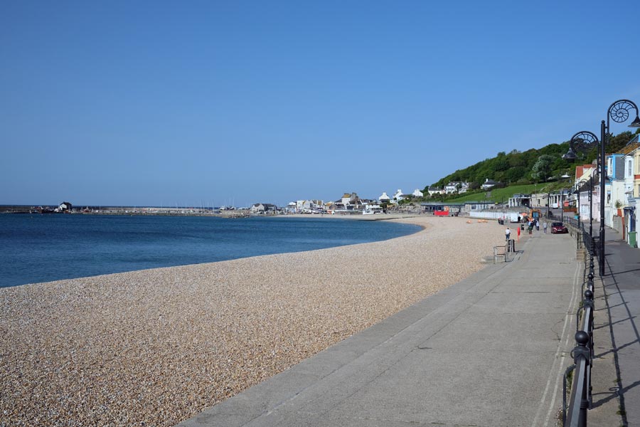
Lyme Regis. Early morning.
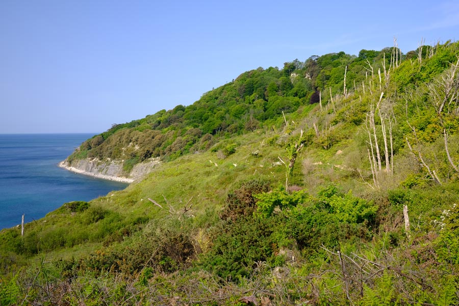
The undercliff
The golf club
Seaton
Beer
End of day 1. About 9 miles walked today.
back to start of Devon in reverse
Day 2 - SWCP Beer to Sidmouth.
Branscombe Mouth
Salcombe Regis
Sidmouth
End of day 2. About 9 miles walked today.
back to start of Devon in reverse
Day 3 - SWCP Sidmouth to Exmouth
High Peak
Ladram Bay
Budleigh Salterton
Exmouth beach. Town end.
End of day 3. About 13 miles walked today.
back to start of Devon in reverse
Day 4 - SWCP Exmouth to Teignmouth
Looking back to Exmouth
Dawlish to Teignmouth walkway.
Waiting for 2 o'clock.
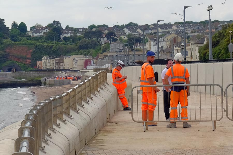
In the distance I could see the official opening taking place (see photo) and just before 2 o'clock the barriers were removed and we were allowed to move forward. By the time that we got to the other end, the opening had been performed and a large crowd of people was surging forward towards us. I continued to walk on and I seemed to have been the first walker heading south along the new officially opened section. After leaving the railway walkway at Dawlish the route became a little more strenuous before rejoining the railway walkway again for the last 1.5 miles into Teignmouth. It was very hot but a cool wind was blowing.
End of day 4. About 8 miles walked today.
As I walked I had decided that I was carrying more weight in my rucksack than I could comfortably carry. Either I wasn't as fit as I thought, or my age was catching up on me. So I took the next train home to Dorset and lightened my pack. Because the weather was supposed to stay fine I discarded the tent along with my heavy bad-weather clothes and my spare clothes. I rested for a few days and booked a few B and Bs for the first part of the onward journey. I had managed to reduced my pack from 12Kg to about 8Kg, which included a light sleeping bag and a bivvy bag.
back to start of Devon in reverse
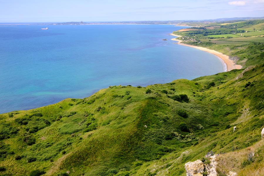
Day 5 - SWCP Teignmouth to Babbacombe
The Teignmouth to Shaldon Ferry
The end of Oddicombe Beach
End of day 5. About 8 miles walked to get to Babbacombe plus a couple more towards Torquay marina.
back to start of Devon in reverse
Day 6 - SWCP Babbacombe to Brixham
 Early morning. Torbay.
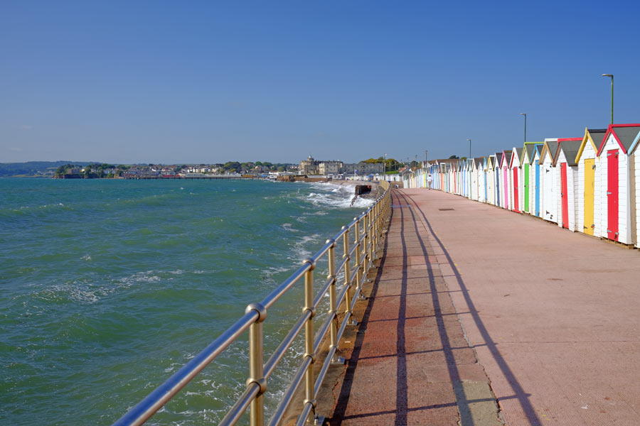
Paignton
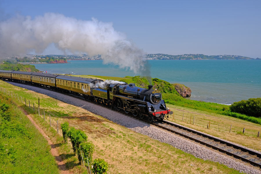
Paignton to Kingswear Heritage Line
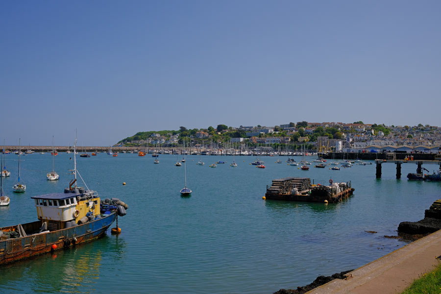
Arriving at Brixham
End of day 6. About 14 miles walked today.
back to start of Devon in reverse
Day 7 - SWCP Brixham to Dartmouth
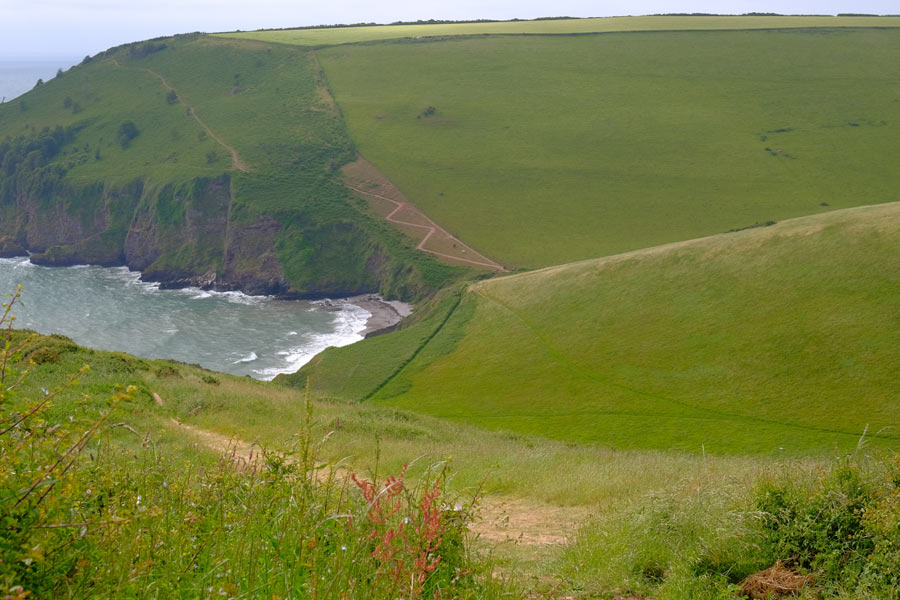
Scabbacombe Head
Forward Point
The Kingsbridge - Dartmouth Ferries
End of day 7. About 10 miles walked today.
back to start of Devon in reverse
Day 8 - SWCP Dartmouth to Salcombe
Blackpool Sands
Slapton Sands with Torcross at the far end.
Narrow and rocky.
End of day 8. 23 miles walked today. My best so far.
back to start of Devon in reverse
Day 9 - SWCP Salcombe to the River Erme.
Sunrise as I left Salcombe
Between Bolt Head and Bolt Tail.
Hope Cove.
Heading for Bantham. Burgh Island in the distance.
After Bantham
A little while later I met some students who had a car and was able to get a lift with them to the other side of the river. I gave them some cash for petrol as I was happy not to have to wade the river. I remembered the time that I waded across in the opposite direction about 20 years ago. That had been a 4am low tide. But I missed my way as I crossed, up to my knees in water, and didn't get to this beach but ended up a little farther down river where I had to scramble up a steep bank, through dense undergrowth and over a fence in the dim light to find the path again.
End of day 9. A little over 17 miles walked today.
back to start of Devon in reverse
Day 10 - SWCP River Erme to Plymouth
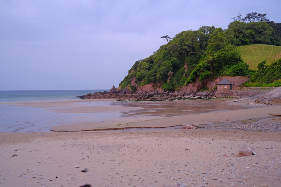
Early morning Meadowsfoot Beach
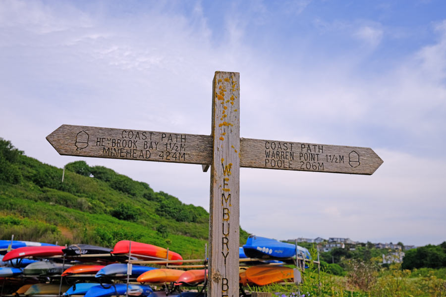
Signpost at Wembury Beach
Fort Bovisand ahead and Plymouth beyond
By then my knee was getting really painful and as I neared the ferry at Mout Batten I spotted a bus shelter. According to the timetable there was a bus due in ten minutes that went right past the railway station.
From the bus stop I looked at the long, baking hot road where I thought the ferry point was and checked the ferry times on my iphone. I calculated that I might just get there before it sailed, or then again I might not, depending on how fast I could hobble. So I caught the bus, which then gave me a tour of the suburbs before it reached the station. With the help of a couple more Ibuprofen tablets I had a pleasant train journey home.
Later I found out that I was heading for the wrong place for the ferry anyway.
End of day 10. A little over 17 miles walked today - 5 of them hobbling along!
That's a Total of 123 miles along the East and South Devon coast and a total of 219 miles from South Haven Point. The Cornwall coast is next but that will be later in the year if my knee will allow me.
This walk through Dorset and Devon was mostly done during the hottest parts of 2022 and 2023 and I only needed my wet weather gear for 10 minutes at the end of the first day as I walked to the bus stop at Langton Maltravers. I would rather have walked in slightly cooler conditions but I'm not complaining.
back to start of Devon in reverse
Next
2024. I decided not to carry on and walk the SWCP around the Cornish coast again. My knee was just not able to cope with walking over severe terrain. I decided instead that my next walk would be the 87 mile Tamara Coast to Coast Way that roughly follows the river Tamar and the Devon/Cornwall border along the Tamar Valley from Plymouth to the source of the Tamar and then on to the North Cornwall coast where it meets the Devon Coast. Looking at the route it was obviously going to be an easier walk than the rugged terrain of the Cornish coast path. I remember it well from the last time.
England Coast Path - Hampshire border to South Haven Point

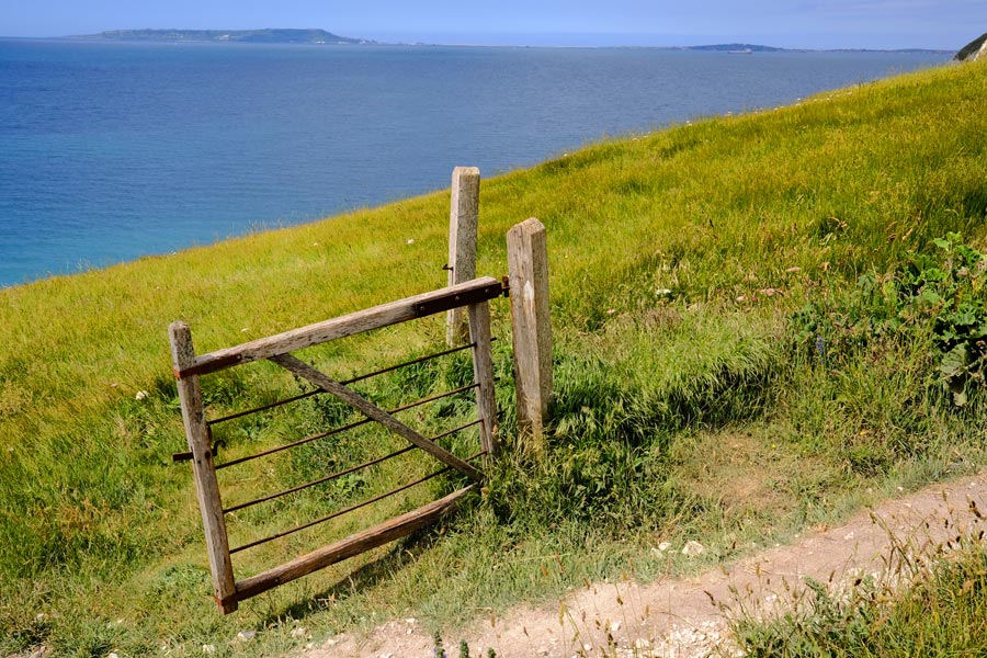
After walking most of the Dorset coast on the SWCP on two occasions I decided to walk what was left. This being the 18 miles from the Hampshire/Dorset border to Sandbanks and the ferry to South Haven Point.
The photos for this walk were taken on a Fujifilm X-E3 using a Fuji 27mm f2.8 lens or a Fuji 18mm f2 wide-angle lens.
Walkford Brook at Christchurch Bay
Highcliffe Beach
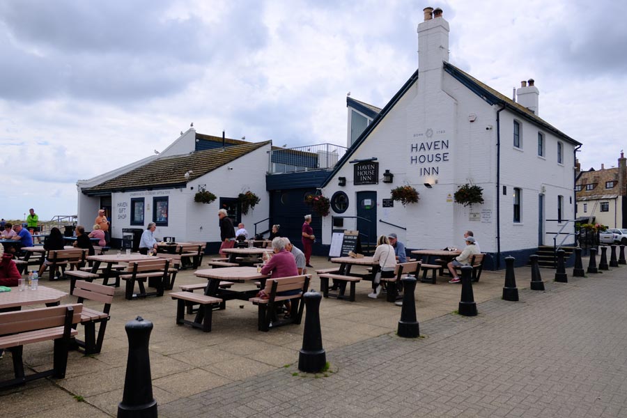
The Haven House Inn
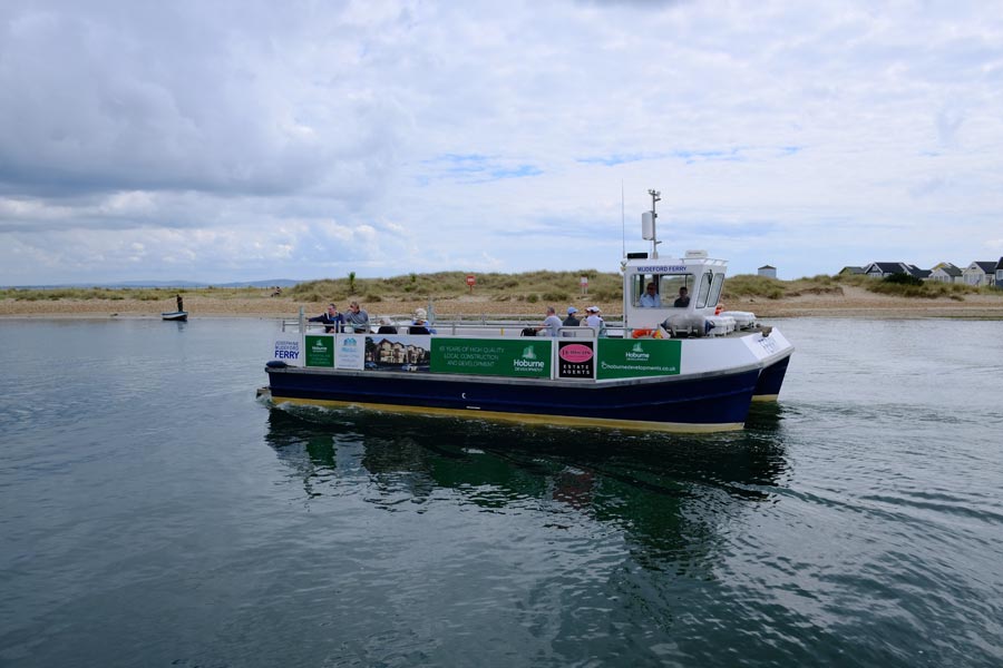
The Ferry to Hengistbury Head
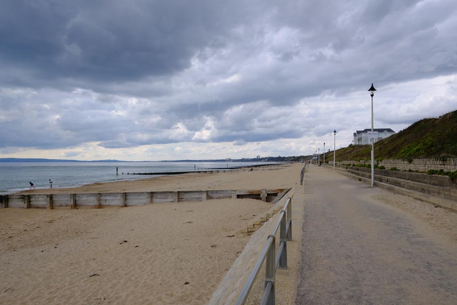
Southbourne Beach

Bar Bus
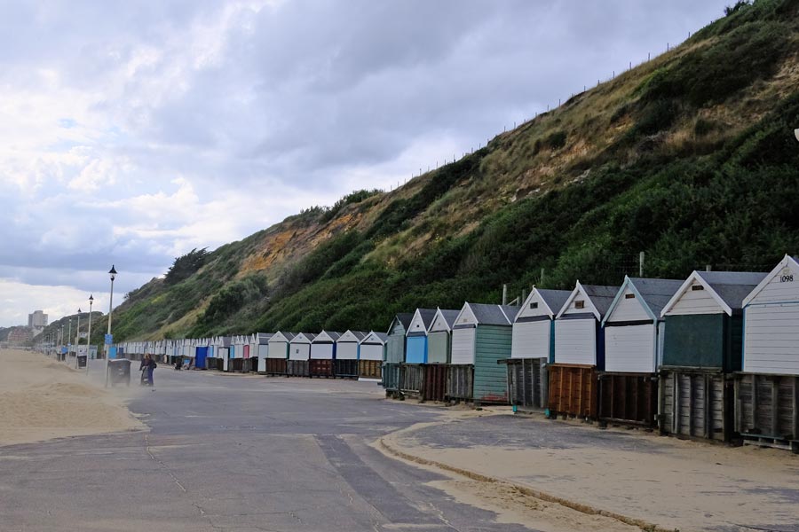
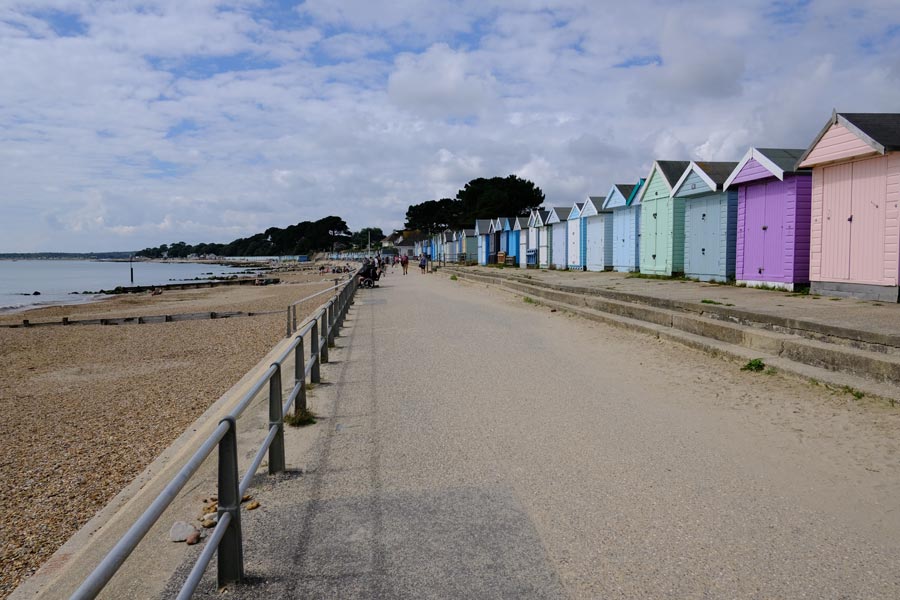
Beach Huts
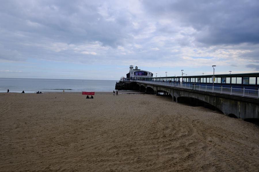
Bournemouth Pier.
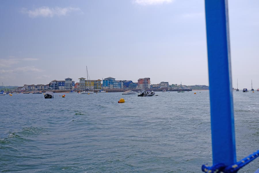
Heading toward Sandbanks.
Sandbanks.
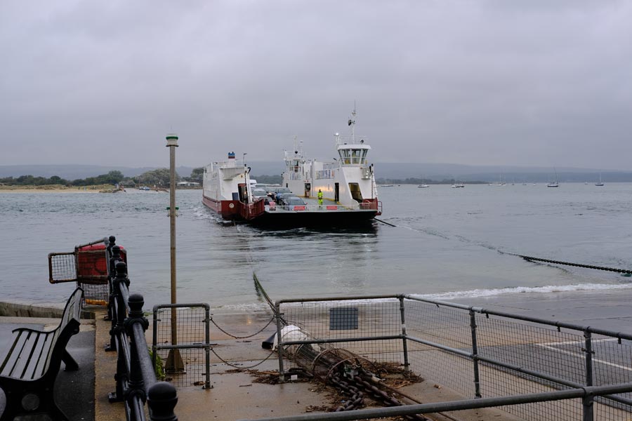
The Sandbanks Chain Ferry to South Haven Point.
About 18 miles walked. Easy walking all the way. Most of it dry.
Including the 89 miles walked previously on the Dorset SWCP, that's a total of 107 miles walked along the whole Dorset coast.
(I later found out that there are about 2000 beach huts along Poole Bay!m,0)
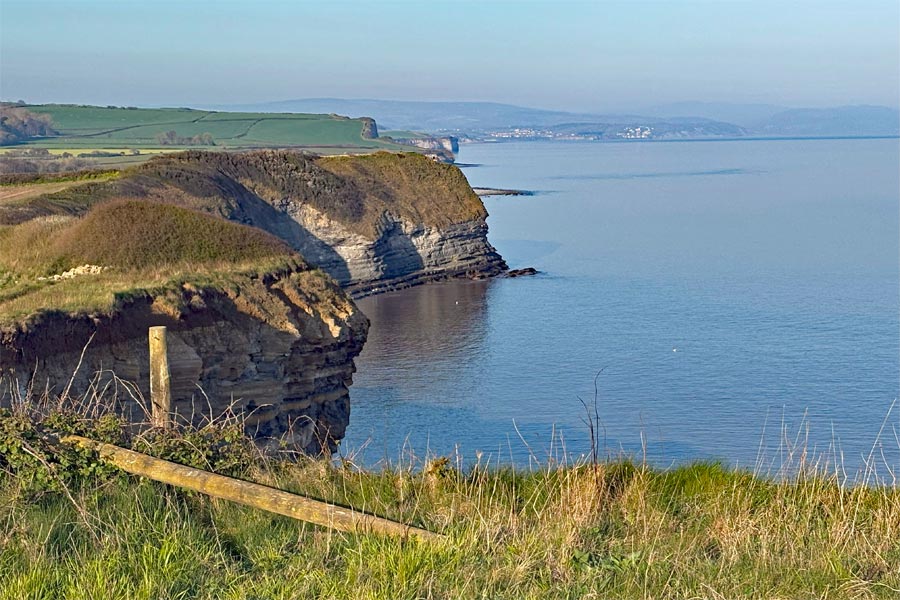
I decided that as I had walked most of the Somerset coast when I walked the SWCP starting at Minehead, I would walk the rest of The coast from Weston Super Mare to Minehead. This would be on the King Charles III England Coast Path.
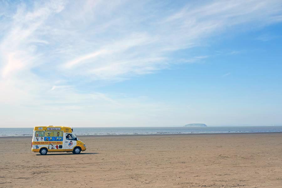
England Coast Path Weston-Super-Mare to Minehead 2025
Passing through: Brean, Berrow, Burnham-on-Sea, Highbridge, Bridgewater, Hinkley Point, Watchet and Blue Anchor.
The photos for this section were taken on a Fujifilm X-E3 with a 27mm lens (35mm equivalent) and an iPhone 16. The iPhone was used for the wide angle shots.
I pre-booked accommodation for three nights and took a bivvy bag, sleeping bag and inflatable mat for the night that I was unable to book.
 |
 |
| Weston-Super-Mare Pier | Near Uphill |
 |
 |
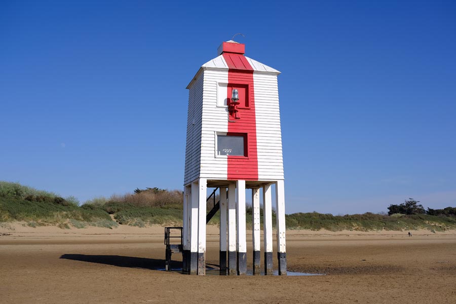
| Burnham-on-Sea Low Lighthouse 1832 | The mouth of the River Parrett |
Day 1. The King Charles III England Coast Path Starts where the River Severn ends and the Bristol Channel begins at Weston-Super-Mare. It was an April Tuesday, early in the season so there were few people about. The sun was warm but there was a cold wind blowing from the east. I kept my fleece on for most of the day. The walk along Weston beach and Berrow Flats beach was easy on the firm, damp sand. At Burnham the path leaves the beach. Here I stopped for a pint at the Reeds Arms, where, sheltered from the wind, I sat in the sun for a while, before I diverting inland to Highbridge where my accommodation was.
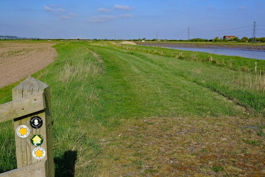
Day 2. Weather the same as yesterday, I walked about 2.5 miles before crossing the River Brue and reaching the mouth of the River Parrett on the Bristol Channel. I looked across to Steart Point, less that half a mile away on the other side of the Parrett. In the distance I could also see the Hinkley power stations, where I intend to be tomorrow night. I then started on the 22 miles or so detour along the wildly meandering banks of the River Parrett and after 11.5 miles I reached the bridge at Bridgwater. I continued on into town to where my accommodation for the night was.
 |
 |
| Returning along the Parrett to the Bristol Channel | Low tide on the Bristol Channel at Steart |
 |
 |
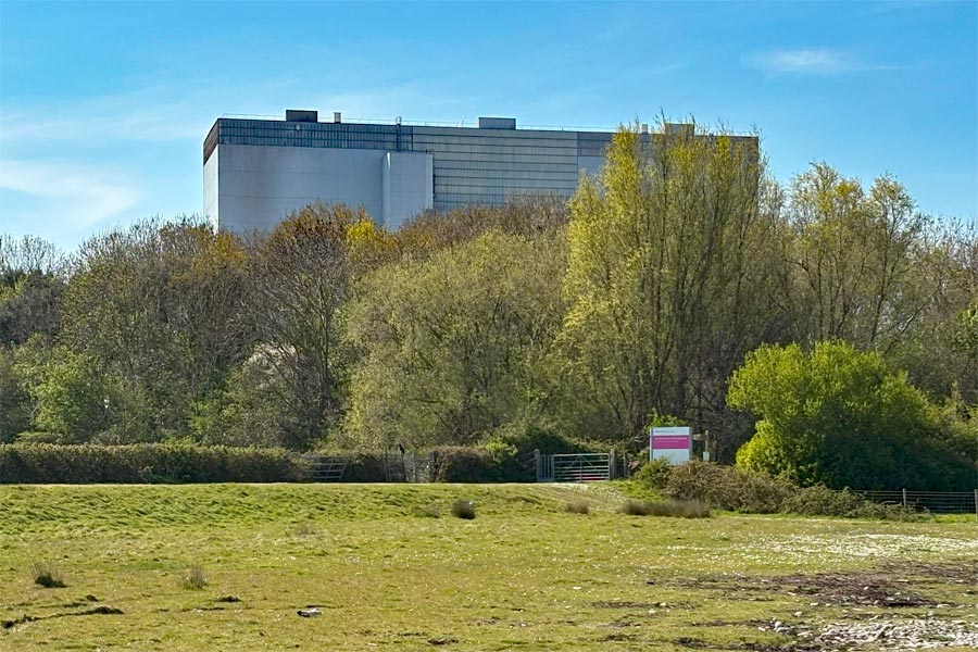
| The remains of Hinkley Point A Nuclear Power Station | The Hinkley Point C nuclear reactors |
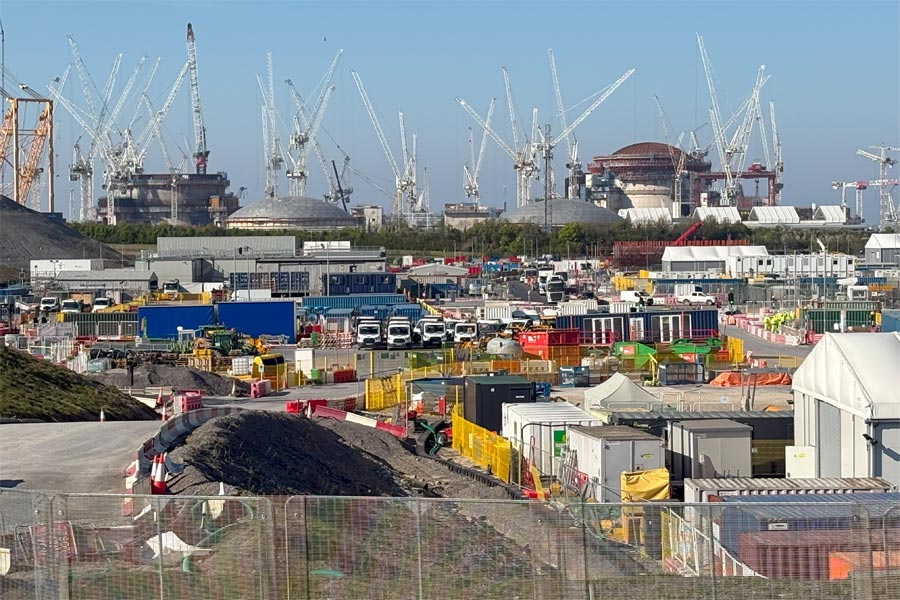
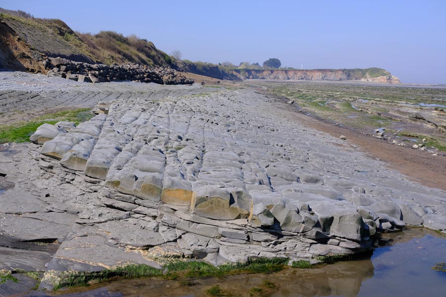
Day 3. Still sunny and with a cold wind out in the exposed fields, I followed the River Parrett back to the Bristol Channel. At Hinkley Point I knew that the coast path was closed so I followed the designated diversion. I was appalled find myself directed along a very narrow strip of land with long grass hiding the holes in the very uneven ground, with a high fence close on one side and a steep sided water filled ditch dangerously close on the other side. This I walked along very carefully as there was no one else around. Then I crossed the immaculate new road to the site, with fast traffic and white busses passing backwards and forwards every few minutes carrying site workers. Soon the signage pointed me towards rough ground again but this time it was too waterlogged to walk through, so I had to walk on a narrow, uneven grass verge next to the heavy traffic before reaching the safety of a pedestrian pavement. On seeing the immaculate infrastructure for traffic I wondered why a little more care had not been taken to provide and maintain a safe, well-marked diversion for coast path walkers.
 |
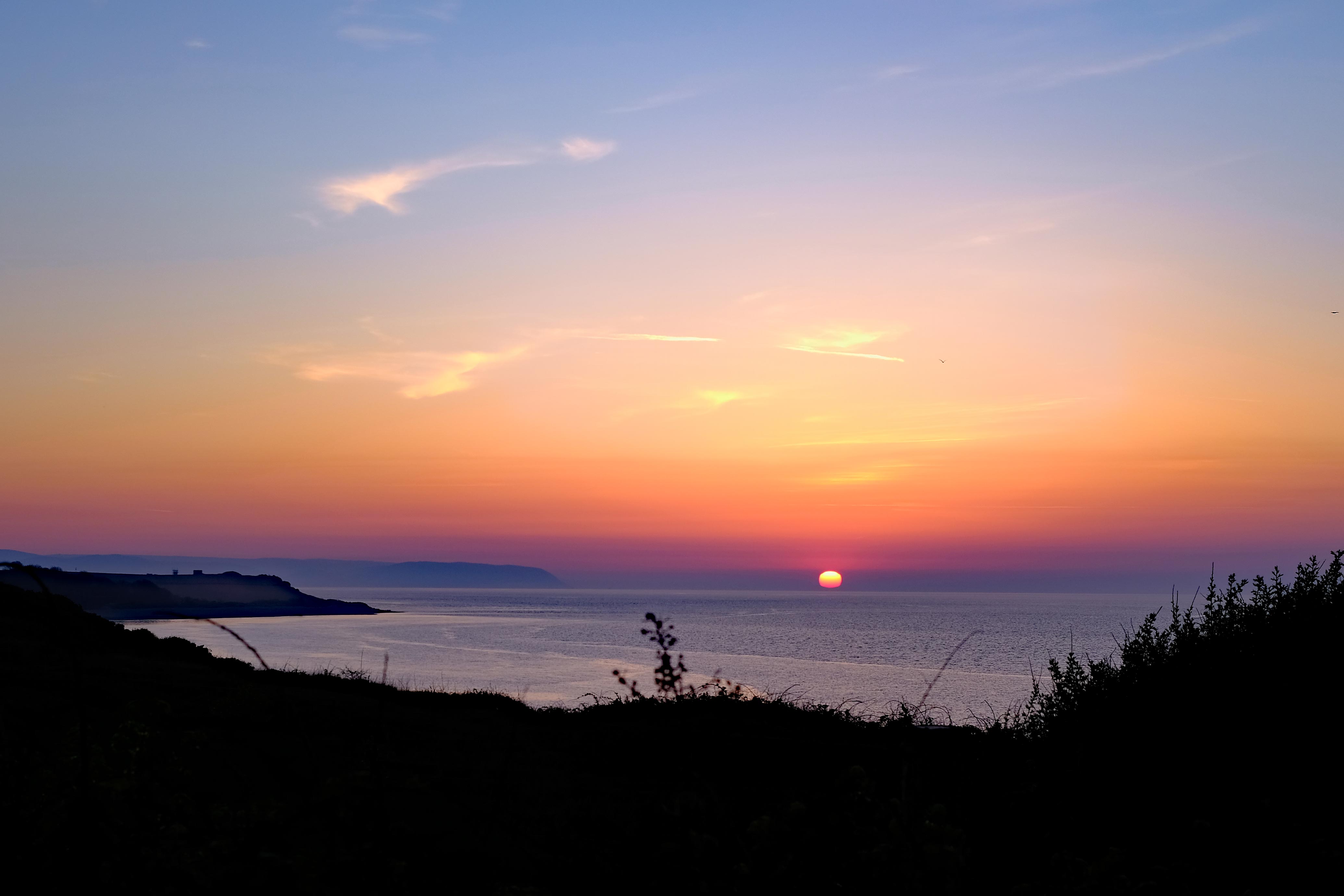 |
| Heaps of excavated rock and earth | Sunset over the Channel |
 |
 |
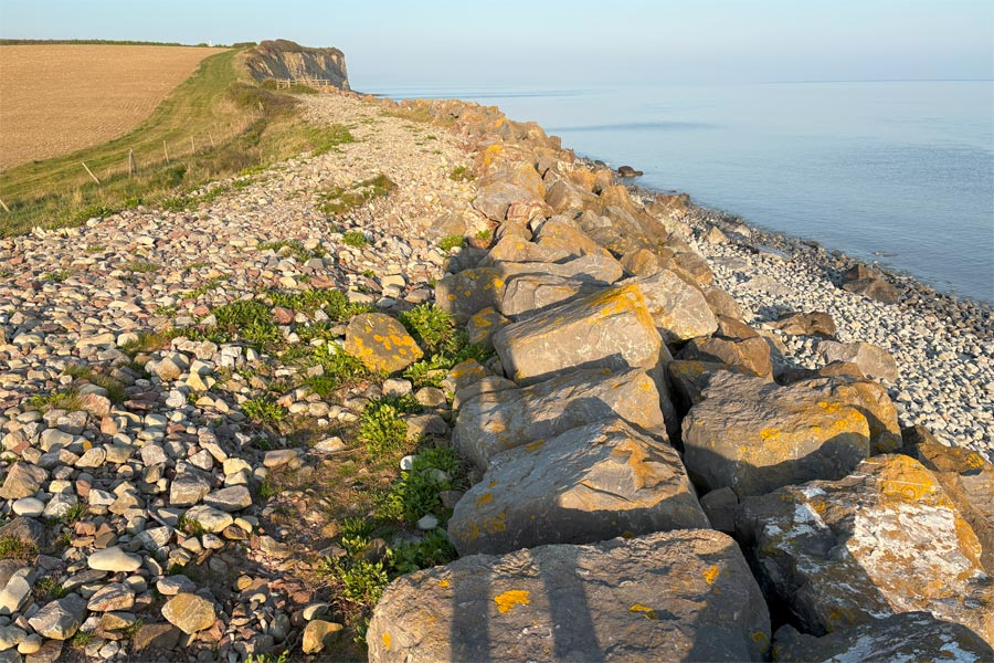
| Large pebbles on the path | The cliffs near Kilve |
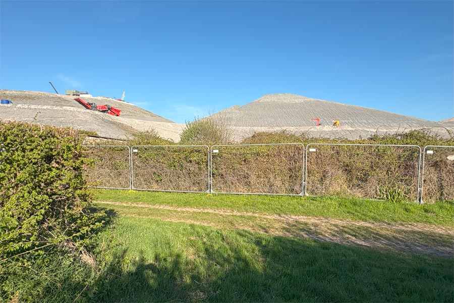
As I walked the final mile of the diversion back to the coast I passed by the huge mountains of excavated rock and earth that had been excavated for the new power station, with huge machines on them that looked like tiny toys.
As I was unable to get accommodation for this part of the walk I bivvied for the night in a sheltered spot out of the wind. It was a clear night with an almost full moon but the brighter stars could still be seen. It was cold. I lay there looking at the stars and watching the passing satellites but it was too cold to sleep. So after a few hours I remembered that I had an emergency space-blanket in my rucksack. With this wrapped around me inside my sleeping bag I got warm enough to sleep.
Day 4. I was up and walking along the coast again at 7am.
 |
 |
| Ledges of rock on the beach | Watchet Harbour |
 |
 |
| Approaching Minehead | The start of the SWCP |
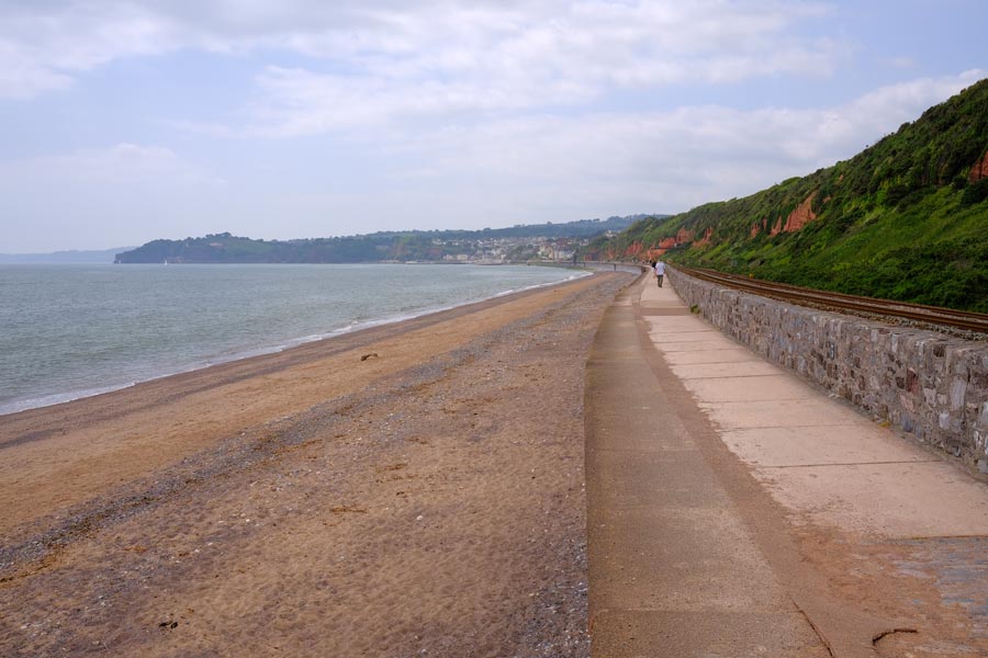
The coast path is along the beach at St Audrie's Bay and Hellwell Bay so it cannot be used during high tides. There is no alternative safe route for walkers. The tide was low when I walked through. Some ledges and layers of rock have slippery seaweed and rock pools. Some of the layers look as if they are remnants of some huge man-made cobbled road. I had accommodation near Watchet so I got a good nights sleep.
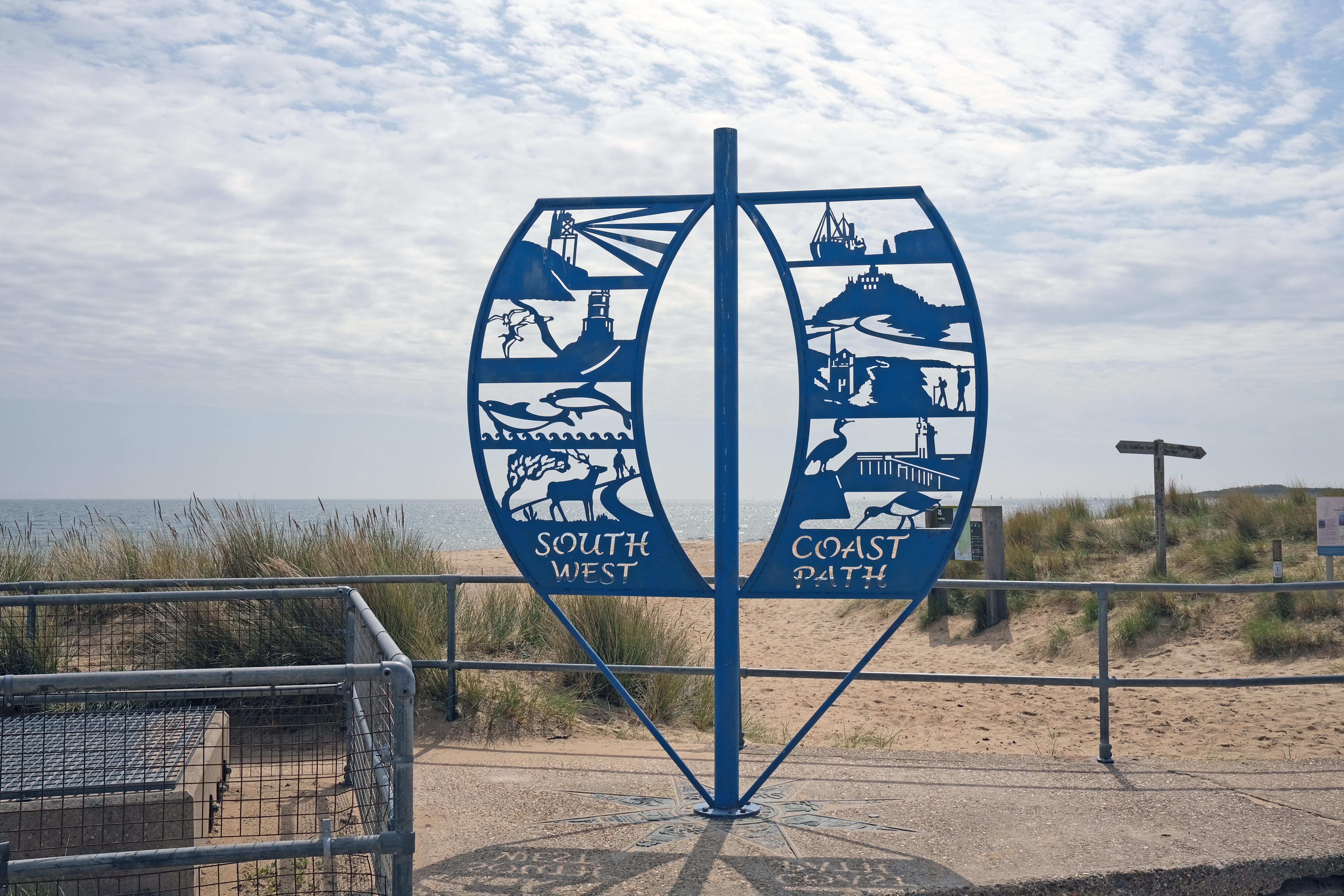
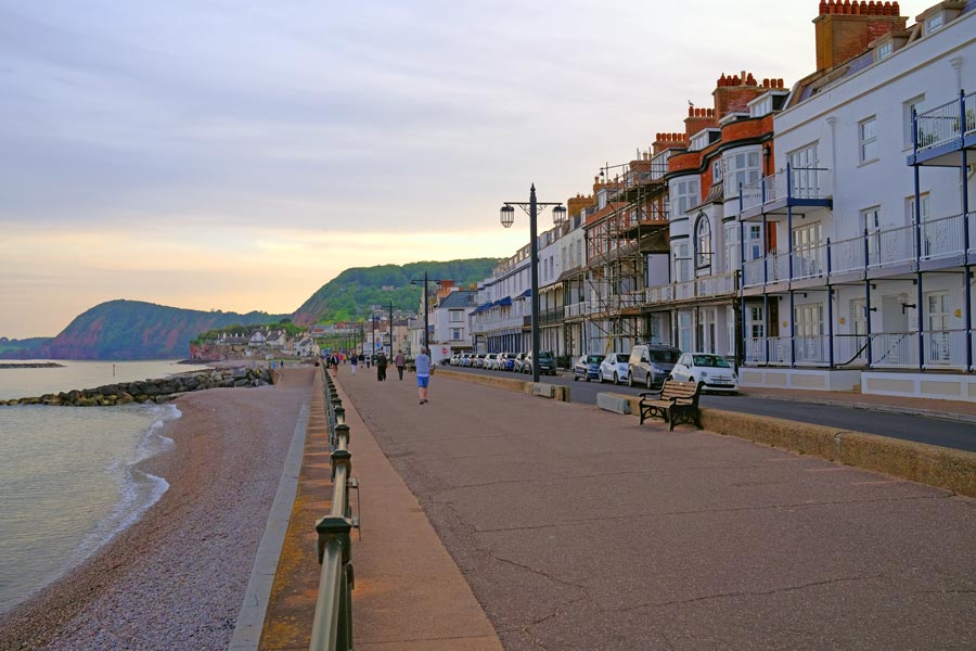
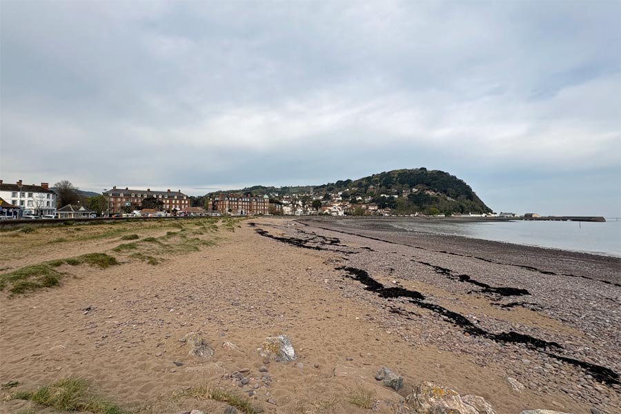
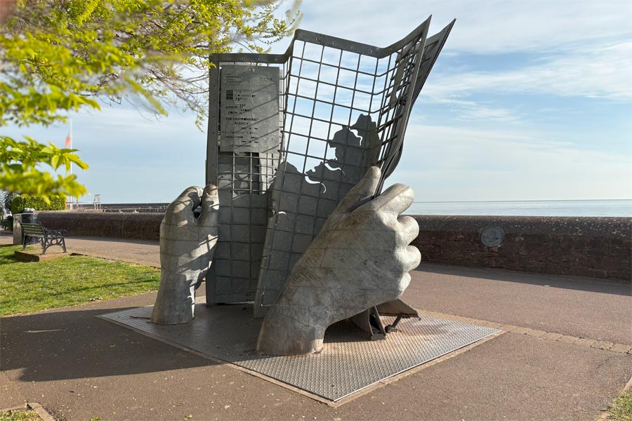
Day 5 was a short walk into Minehead. The hills and cliffs ended just before Blue Anchor and the rest of the walk was easy going along the shore. The clouds had rolled in Before I caught my number 28 bus to Taunton Railway Station I went to see the sculpture at the start of the South West Coast Path. When I first started the SWCP in 1999 there was only a small sign where the path used to start from.
By walking this 70 mile stretch of the England Coast Path I have now walked the coasts of Somerset, Devon, Cornwall and Dorset. Which works out at about 720 miles. Next I will be walking east along the Hampshire coast.
swcp.uk
All photos © Martyn Pearce